River Severn
2008/9 Schools Wikipedia Selection. Related subjects: Geography of Great Britain
| River Severn | |
| Welsh: Afon Hafren, Latin: Sabrina | |
| River | |
|
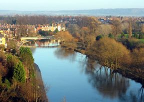
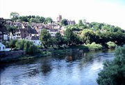
The Severn at Shrewsbury from Shrewsbury Castle.
|
|
| Countries | Wales, England |
|---|---|
| Regions | Mid Wales, West Midlands, South West |
| Counties | Powys, Shropshire, Worcestershire, Gloucestershire |
| Tributaries | |
| - left | Vyrnwy, Tern, Stour, Warwickshire Avon, Bristol Avon |
| - right | Teme, Wye |
| Cities | Shrewsbury, Worcester, Gloucester, Bristol |
| Landmarks | Ironbridge Gorge, Severn Valley, Severn Bore, Severn crossing |
| Source | |
| - location | Plynlimon, Ceredigion, Wales |
| - elevation | 610 m (2,001 ft) |
| - coordinates | |
| Mouth | Severn Estuary |
| - location | Bristol Channel, United Kingdom |
| - elevation | 0 m (0 ft) |
| Length | 354 km (220 mi) |
| Basin | 11,420 km² (4,409 sq mi) |
| Discharge | for Bewdley, Worcs. SO 7815 7622 |
| - average | 61.17 m³/ s (2,160 cu ft/ s) |
| - max | 533.48 m³/ s (18,840 cu ft/ s) max recorded on 1947- 03-21 |
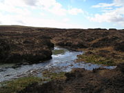
The River Severn ( Welsh: Afon Hafren, Latin: Sabrina) is the longest river in Great Britain, at 220 miles (354 km). It rises at an altitude of 2,001 feet (610 m) on Plynlimon near Llanidloes, Powys, in the Cambrian Mountains of mid Wales. It then flows through Shropshire, Worcestershire and Gloucestershire, with the county towns of Shrewsbury, Worcester, and Gloucester on its banks. With an average discharge of 107 m³/s at Apperley, Gloucestershire, the Severn is England's greatest river in terms of water flow, and is considered one of the ten major rivers of the United Kingdom.
The river becomes the Severn Estuary after the Second Severn Crossing near Severn Beach, South Gloucestershire. The river then discharges into the Bristol Channel which in turn discharges into the Celtic Sea and the wider Atlantic Ocean. The Severn's drainage basin area is 11,420 square kilometres (4,409 sq mi), excluding the River Wye and Bristol Avon which flow into the Bristol Channel. The major tributaries to the Severn are the Vyrnwy, Teme, Warwickshire Avon and Stour.
Mythology
According to some sources, the name "Severn" is derived from the name Sabrina or ( Hafren), based on the mythical story of the drowning of a nymph in the river. Sabrina is also the goddess of the River Severn in Brythonic mythology. The story of Sabrina is featured in Milton's Comus. There is a statue of 'Sabrina' in the Dingle Gardens at the Quarry, Shrewsbury.
As the Severn becomes tidal the associated deity changes to Noadu, who (Romanized as Nodens) is represented mounted on a seahorse, riding on the crest of the Severn bore.
Tributary rivers
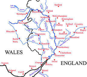
The River Stour rises in the north of Worcestershire in the Clent Hills, near St Kenelm's Church at Romsley. It flows north into the adjacent West Midlands at Halesowen. It then flows westwards through Cradley Heath and Stourbridge where it leaves the Black Country. It is joined by the Smestow Brook at Prestwood before it winds around southwards to Kinver, and then flows back into Worcestershire. It then passes through Wolverley, Kidderminster and Wilden to its confluence with the Severn at Stourport-on-Severn.
The River Vyrnwy, which begins at Lake Vyrnwy, flows eastwards through Powys before entering England and joining the Severn at Melverley, Shropshire. The Rea Brook flows north from its source in the Shropshire Hills and joins the Severn at Shrewsbury. The River Tern, after flowing south from Market Drayton and being joined by the River Roden, meets the Severn at Attingham Park.
The River Worfe joins the Severn, just above Bridgnorth. The River Stour rising on the Clent Hills and flowing through Halesowen, Stourbridge, and Kidderminster, joins the Severn at Stourport. On the opposite bank, the tributaries are only brooks, Borle Brook, Dowles Brook draining the Wyre Forest and Dick Brook.
The River Teme flows eastwards from its source in Mid Wales, straddling the border between Shropshire and Herefordshire, it is joined by the River Onny, River Corve and River Rea before it finally joins the Severn slightly downstream of Worcester.
One of the several rivers named Avon, in this case the Warwickshire Avon, flows west through Rugby, Warwick and Stratford-upon-Avon. It is then joined by its tributary the River Arrow, before finally joining the Severn at Tewkesbury, Gloucestershire.
The port of Bristol is located at the mouth of the Severn, where another River Avon flows into it through the Avon Gorge.
The River Wye, from its source in Plynlimon, Wales, flows generally southeast through the Welsh towns of Rhayader and Builth Wells. It enters Herefordshire, flows through Hereford, and is shortly afterwards joined by the River Lugg, before flowing through Ross-on-Wye and Monmouth, and then southwards where it forms the boundary between England ( Forest of Dean) and Wales. It flows into the Severn near the town of Chepstow, slightly upstream of the Bristol Avon on the opposite bank.
The River Usk flows into the Severn estuary just south of Newport.
Major settlements
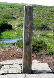
Below is a list of major towns and cities that the Severn flows through (from north to south):
- Through Powys:
- Newtown
- Welshpool (county town)
- Through Shropshire
- Shrewsbury (county town)
- Ironbridge
- Bridgnorth
- Through Worcestershire
- Bewdley
- Stourport
- Worcester (county town)
- Upton
- Through Gloucestershire
- Tewkesbury
- Gloucester (county town)
Transport
Bridges
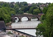
The Severn is bridged at many places, and many of these bridges are notable in their own right, with several designed and built by the engineer Thomas Telford. There also is the famous Iron Bridge at Ironbridge, which is the first ever iron bridge in the world.
The two bridges of the Severn crossing carrying roads (opened in 1966 and 1996) link Wales with the southern counties of England and are among the most important in Britain.
- Severn Bridge — opened in 1966 carrying the M48
- Second Severn Crossing — opened in 1996 carrying the M4 motorway
Previous to the construction of the first bridge in 1966, the channel was crossed by the Aust Ferry.
Rail
The Severn Tunnel, situated near the Second Severn Crossing road bridge, carries the Great Western Main Line under the channel.
Cars could also be transported through the Severn Tunnel. In the 1950s three trains a day made round trips between Severn Tunnel Junction and Pilning. The vehicles were loaded onto open flat bed carriages and pulled by a small pannier tank locomotive although sometimes they were joined to a scheduled passenger train. The prudent owner paid to cover the vehicle with a sheet as sparks often flew when the steam locomotive tackled the grade leading to the tunnel exit. A rail coach was provided for passengers and drivers. Reservations could be made and the fee for the car was about thirty shillings in the early 1950s.
Disasters
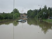
There have been many disasters on the Severn, making it Britain's most dangerous river. It has claimed many lives (figures vary depending on how it is recorded, circa 300 people), especially during the 20th century.
Locks
There are locks on the lower Severn to enable sea going boats to reach as far as Stourport. The most northerly lock is at Lincombe, about a mile downstream from Stourport.
Associated canals
| River Severn | |||||||||||||||||||||||||||||||||||||||||||||||||||||||||||||||||||||||||||||||||||||||||||||||||||||||||||||||||||||||||||||||||||||||||||||||||||||||||||||||||||||||||||||||||||||||||||||||||||||||||||||||||||||||||||||||||||||||||||||||||||||||||||||||||||||||||||||||||||||||||||||||||||||||||||||||||||||||||||||||||||||||||||||||||||||||||||||||||||||||||||||||||||||||||||||||||||||||||||||||||||||||||||||||||||||||||||||||||||||||||||||||||||||||||||||||
|---|---|---|---|---|---|---|---|---|---|---|---|---|---|---|---|---|---|---|---|---|---|---|---|---|---|---|---|---|---|---|---|---|---|---|---|---|---|---|---|---|---|---|---|---|---|---|---|---|---|---|---|---|---|---|---|---|---|---|---|---|---|---|---|---|---|---|---|---|---|---|---|---|---|---|---|---|---|---|---|---|---|---|---|---|---|---|---|---|---|---|---|---|---|---|---|---|---|---|---|---|---|---|---|---|---|---|---|---|---|---|---|---|---|---|---|---|---|---|---|---|---|---|---|---|---|---|---|---|---|---|---|---|---|---|---|---|---|---|---|---|---|---|---|---|---|---|---|---|---|---|---|---|---|---|---|---|---|---|---|---|---|---|---|---|---|---|---|---|---|---|---|---|---|---|---|---|---|---|---|---|---|---|---|---|---|---|---|---|---|---|---|---|---|---|---|---|---|---|---|---|---|---|---|---|---|---|---|---|---|---|---|---|---|---|---|---|---|---|---|---|---|---|---|---|---|---|---|---|---|---|---|---|---|---|---|---|---|---|---|---|---|---|---|---|---|---|---|---|---|---|---|---|---|---|---|---|---|---|---|---|---|---|---|---|---|---|---|---|---|---|---|---|---|---|---|---|---|---|---|---|---|---|---|---|---|---|---|---|---|---|---|---|---|---|---|---|---|---|---|---|---|---|---|---|---|---|---|---|---|---|---|---|---|---|---|---|---|---|---|---|---|---|---|---|---|---|---|---|---|---|---|---|---|---|---|---|---|---|---|---|---|---|---|---|---|---|---|---|---|---|---|---|---|---|---|---|---|---|---|---|---|---|---|---|---|---|---|---|---|---|---|---|---|---|---|---|---|---|---|---|---|---|---|---|---|---|---|---|---|---|---|---|---|---|---|---|---|---|---|---|---|---|---|---|---|---|---|---|---|---|---|---|---|---|---|---|---|---|---|---|---|---|---|---|---|---|---|---|---|---|---|---|---|---|---|---|---|---|---|---|---|---|---|---|---|---|---|---|---|---|---|---|---|---|---|---|---|---|---|---|---|---|---|
|
legend
|
|||||||||||||||||||||||||||||||||||||||||||||||||||||||||||||||||||||||||||||||||||||||||||||||||||||||||||||||||||||||||||||||||||||||||||||||||||||||||||||||||||||||||||||||||||||||||||||||||||||||||||||||||||||||||||||||||||||||||||||||||||||||||||||||||||||||||||||||||||||||||||||||||||||||||||||||||||||||||||||||||||||||||||||||||||||||||||||||||||||||||||||||||||||||||||||||||||||||||||||||||||||||||||||||||||||||||||||||||||||||||||||||||||||||||||||||
The Staffordshire and Worcestershire Canal, the Worcester and Birmingham Canal, and the Herefordshire and Gloucestershire Canal all join the Severn at Stourport, Worcester and Gloucester respectively. The Droitwich Barge Canal used to join the Severn at Hawford, near to the River Salwarpe and it hoped that a new link to the Severn via the Salwarpe will be re-established in the future.
Paddle steamers
The main operator of pleasure craft and particularly paddle steamers on the river from the mid-1800s to the late 1970s were P and A Campbell of Bristol, but also included the Barry Railway Company. There were also three ferries operating between Aust and Chepstow these were called the Severn King, Severn Queen and Severn Princess. The Severn Princess is currently undergoing restoration after being found in Ireland full of fertiliser, after dragging her back with her sinking twice on the way it is hoped that at some time in the near future she will be fully operational again. The Severn King and Queen were scrapped not long after their decommission following the completion of the First Severn Bridge.
In Worcester, the Worcester River Cruises have boat trips up and down the river operating the boats The Pride of the Midlands and The Earl Grosvenor. After 2008 there are plans for another boat, The Severn Travellor, to be refurbished and relaunched for trips.
Severn Estuary
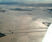
The River Severn extends down to the Second Severn Crossing. The Severn Estuary begins at this point and stretches to a line from Lavernock Point (south of Cardiff) to Sand Point near Weston-super-Mare. West of this line is the Bristol Channel. In the Severn estuary (or the Bristol Channel in the last two cases, depending where the boundary is drawn) are the rocky islands called Denny Island, Steep Holm and Flat Holm.
Severn bore
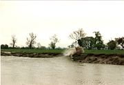
A curious phenomenon associated with the lower reaches of the Severn is the tidal bore. The Severn bore forms somewhat upstream of the Port of Sharpness, which is also the Southern terminus of the Gloucester and Sharpness Canal.
The river's estuary, which empties into the Bristol Channel, has the second largest tidal range in the world — about 15 metres (49 ft), exceeded only by the Bay of Fundy ; and during the highest tides, the rising water is funnelled up the estuary into a wave that travels rapidly upstream against the river current. The largest bores occur in spring, but smaller ones can be seen throughout the year. The Environment Agency publishes timetable and prediction of bore heights on its website.. Being the onset of the flood tide it is accompanied by a rapid rise in water level which continues for about one and a half hours after the bore has passed. The Severn Bore is a natural example of a self-reinforcing solitary wave or soliton.
River surfing enthusiasts even attempt to surf along on the wave, which can be 2 metres (7 ft). In March 2006, an unofficial record surf was achieved, for the longest-ever 'surf', by Steve King, a railway engineer from Gloucestershire, England. Despite the media acceptance of the record the exact distance of the ride was never verified and the record was later rejected by both the British Surfing Association and Guinness World Records. The Gloucester Harbour Trustees, as competent harbour authority for this part of the river, explicitly advise against this pastime.
In September 2005, several hundred surfers gathered in Newnham on Severn to celebrate 50 years since the first recorded attempt at surfing the Severn Bore and to view the première of Longwave by Donny Wright, a historical film documenting the evolution of the sport since its inception in 1955.
Tidal power
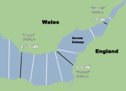
A huge tidal range and high level of surrounding industry and population have long made the Severn estuary and Bristol Channel a focus for tidal energy schemes and ideas. Plans for a Severn Barrage — running 16 km (10 miles) across the Bristol Channel from Lavernock Point near to and south west of Cardiff to Brean Down near and just south west of Weston-super-Mare in Somerset — would generate a massive 8640 MW when the tide flows, and have been discussed for several decades now. The power generated would come from a lake of 185 square miles (479 km²) with a potential energy depth of 14 metres (46 ft). Tidal power only runs for some 10 hours a day, but by using the enclosed lake as a reservoir of potential energy more hours of operation could be achieved. Other energy sources, such as wind and solar power, also create electricity at times that do not always match when it is needed. Excess power could be stored by pumping water uphill, as is already done at a variety of other installations in the UK.
The UK Government shelved the plans in the late 1980s due largely to cost issues and local environmental concerns. However, this was before recent huge rises in the price of energy, and before Global Warming had started to be taken seriously. In April 2006 the Welsh Assembly approved the idea of utilising the tidal power, but the RSPB has raised serious concerns about the effect on the mud flats, that have European Environmental protection status, and the UK government Energy Review published later in the year did not endorse the scheme.
Opinion is still divided on the benefits of a proposed barrage. John Hutton, Secretary of State for Business, Enterprise and Regulatory Reform, announced a further feasibility study on 25 September 2007. The proposal for a hydro-electric barrier to generate 8.6 GW and meet five percent of Britain's power needs, is being opposed by environmental groups.
Industry
A 6 mile (10 km) stretch of the Severn valley in Shropshire, known as the Ironbridge Gorge, was designated a World Heritage Site by UNESCO in 1986. Its historic importance is due to its role as the centre of the iron industry in the early stages of the Industrial Revolution. Ironbridge gets its name from the bridge across the Severn, built in 1779, which was the first cast-iron bridge ever constructed.
Wildlife
The sides of the estuary are also important feeding grounds for waders, notably at the Bridgwater Bay National Nature Reserve and the Slimbridge Wildfowl Trust.
