Image:Boston 1772.gif
From Wikipedia, the free encyclopedia
Size of this preview: 521 × 480 pixels
Full resolution (1,536 × 1,414 pixels, file size: 298 KB, MIME type: image/gif)
Summary
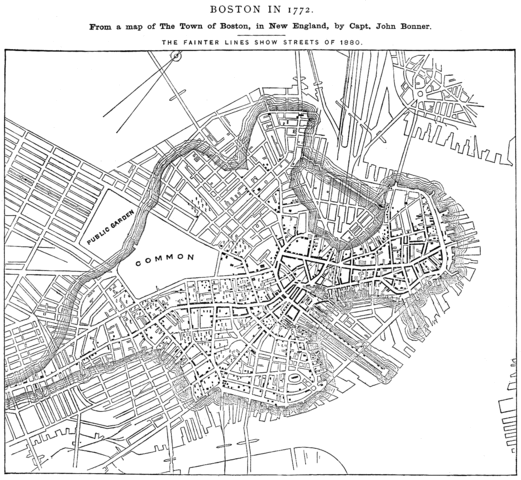
"Boston in 1772. From a map of The Town of Boston, in New England, by Capt. John Bonner" "The fainter lines show streets of 1880." From Report on the Social Statistics of Cities, Compiled by George E. Waring, Jr., United States. Census Office, Part I, 1886.
Edited version of University of Texas image. http://www.lib.utexas.edu/maps/historic_us_cities.html
"No permissions are needed to copy them. You may download them and use them as you wish." http://www.lib.utexas.edu/usage_statement.html?maps=yes
Licensing
 |
This image is in the public domain because its copyright has expired in the United States and those countries with a copyright term of no more than the life of the author plus 100 years. |
File history
Click on a date/time to view the file as it appeared at that time.
| Date/Time | Dimensions | User | Comment | |
|---|---|---|---|---|
| current | 21:51, 13 February 2006 | 1,536×1,414 (298 KB) | Flux.books ( Talk | contribs) | ("Boston in 1772. From a map of The Town of Boston, in New England, by Capt. John Bonner" "The fainter lines show streets of 1880." From Report on the Social Statistics of Cities, Compiled by George E. Waring, Jr., United States. Census Office, Part I, 188) |
See the setup instructions for more information.
File links
The following pages on Schools Wikipedia link to this image (list may be incomplete):
Categories: Author died more than 100 years ago public domain images | Maps of Boston, Massachusetts