Image:Europe biogeography countries.svg
From Wikipedia, the free encyclopedia
Europe_biogeography_countries.svg (SVG file, nominally 3,600 × 2,610 pixels, file size: 876 KB)
| |
This is a file from the Wikimedia Commons. The description on its description page there is shown below. |
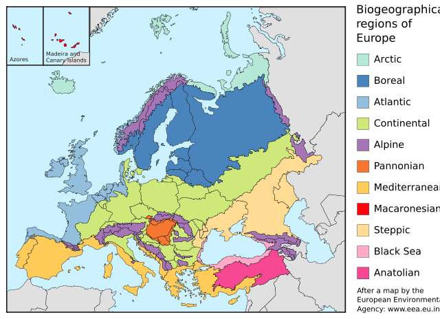
| Description |
Map of the biogeographic regions of Europe, after EEA's map. Shows both country and biogeographical region boundaries. Legend in English. SVG format. |
|---|---|
| Source |
Made with Inkscape from Image:Biogeographical Regions Europe - Map (intl).png by the European Environmental Agency |
| Date |
20 May 2006 |
| Author |
Júlio Reis |
| Permission ( Reusing this image) |
See below.
|
| |
This file is licensed under the Creative Commons Attribution ShareAlike 2.5 License. In short: you are free to share and make derivative works of the file under the conditions that you appropriately attribute it, and that you distribute it only under a license identical to this one. Official license |
File history
Click on a date/time to view the file as it appeared at that time.
| Date/Time | Dimensions | User | Comment | |
|---|---|---|---|---|
| current | 10:48, 23 May 2006 | 3,600×2,610 (876 KB) | Tintazul | ( {{Tintazul| |Description=Map of the biogeographic regions of Europe, after EEA's map. Shows both country and biogeographical region boundaries. Legend in English. SVG format. |Date=20 May 2006 |Source=Made with Inkscape from [[:Image:Biogeographical Regi) |
File links
The following pages on Schools Wikipedia link to this image (list may be incomplete):