Colorado River
2008/9 Schools Wikipedia Selection. Related subjects: North American Geography
| Colorado River | |
|---|---|
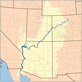
| Map of the Colorado Watershed | |
| Mouth | Gulf of California |
| Basin countries | United States, Mexico |
| Length | 2,330 km (1,450 mi) |
| Source elevation | ~2700 m (~9000 ft) |
| Avg. discharge | 620 m³/s (22,000 ft³/s) |
| Basin area | 629,100 km² (242,900 mi²) |
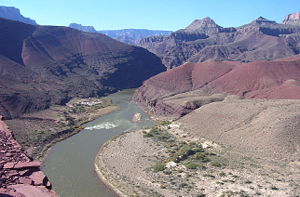
The Colorado River ('Aha Kwahwat in Mojave) is a river in the southwestern United States and northwestern Mexico, approximately 1,450 mi (2,330 km) long, draining a part of the arid regions on the western slope of the Rocky Mountains. The natural course of the river flows into the Gulf of California, but the heavy use of the river as an irrigation source for the Imperial Valley has desiccated the lower course of the river in Mexico such that it no longer consistently reaches the sea.
The Colorado River drains 242,900 sq mi (629,100 km²). Total flows of the river range from 4000 cubic feet per second (113 m³/s) in droughts to 1,000,000 ft³/s (28,000 m³/s) in severe floods. With the construction of massive power dams on the lower course of the river, floods of over 70,000 ft³/s (2000 m³/s) are rare. The mean flow of the total river before diversion is 22,000 ft³/s (620 m³/s). Historically the flow was much higher before water usage began in the basin.
History
Grand River
Until 1921, the section of the Colorado River from its headwaters in Rocky Mountain National Park to its confluence with the Green River in Utah was known as the "Grand River," the origin of several now orphaned names including Grand Lake, Grand Valley, Grand Junction, Grand County, Colorado, and Grand County, Utah. Colorado U.S. Representative Edward T. Taylor petitioned the Congressional Committee on Interstate and Foreign Commerce to rename the Grand River as the Colorado River. On July 25, 1921 the name change was made official in House Joint Resolution 460 of the 66th Congress, over the objections of representatives from Wyoming and Utah and the United States Geological Survey which noted that the drainage basin of the Green River was more than 70% more extensive than that of the Grand River, although the Grand carried a slightly higher volume of water at its confluence with the Green.
Course
Prehistory
It is the opinion of some geologists that before the Gulf of California came into being some 7-8 million years ago, the Colorado River initially had its outlet somewhere along what is now the California coast. They believe that the massive Monterey Submarine Canyon under Monterey Bay along with the associated undersea sedimentary fan may be remnants of the Colorado's ancient outlet. The canyon has moved north to its current location by the action of the San Andreas Fault and would have been approximately where Santa Barbara is located when both the San Andreas Fault and the Gulf of California came into being.
Today
The Colorado River's source is La Poudre Pass Lake, located high in Rocky Mountain National Park, just west of the Continental Divide. Below Rocky Mountain National Park, the river flows through the Kawuneeche Valley and then flows through Grand Lake, the largest natural body of water in Colorado, before being dammed to create Shadow Mountain Reservoir. The river then flows into Lake Granby, another reservoir, and finally begins its journey to the Gulf of California where U.S. Highway 40 roughly parallels the river to the town of Kremmling, where it enters Gore Canyon. Most of the river's tributaries within Colorado are small. However there are exceptions, such as the Gunnison and Roaring Fork Rivers, in which massive amounts of water flow. About a hundred miles later it meets the Eagle River in the town of Dotsero, Colorado and where I-70 parallels the river through Glenwood Canyon. The river then passes through the city of Glenwood Springs where it is joined by the swift flowing Roaring Fork River. West of Glenwood Springs, the Colorado runs through the Grand Valley and is joined by the Gunnison River in Grand Junction. From there it flows westward to the Utah border and Westwater Canyon. The Colorado here ranges from 200 to 1200 feet wide (60 to 370 m) and from 6 to 30 feet in depth (2 to 9 m) with occasional deeper areas.
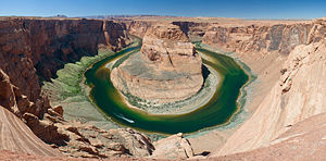
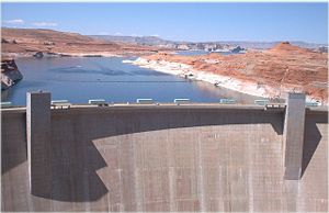
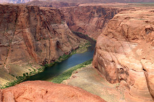
The river turns southwest near Fruita, Colorado and is joined by the Dolores River soon after entering Utah. It partially forms the southern border of Arches National Park near Moab, Utah and then passes by Dead Horse Point State Park and through Canyonlands National Park where it is met by one of its primary tributaries, the Green River. The Colorado then flows into Lake Powell, formed by the Glen Canyon Dam. Below the dam, water released from the bottom of Lake Powell makes the river clear, clean, and cold. Just south of the town of Page, Arizona, the river forms the dramatic Horseshoe Bend, then at Lees Ferry is joined by another tributary, the warm, shallow, muddy Paria River, and begins its course through Marble Canyon. Here, the Colorado ranges from 175 to 700 feet in width (53 to 213 m) and 9 to 130 feet in depth (3 to 40 m).
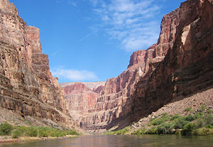
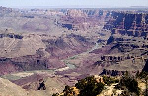
At the southern end of Marble Canyon, the river is joined by another tributary, the Little Colorado, and the river then turns abruptly west directly across the folds and fault line of the plateau, through the Grand Canyon, which is 217 miles long (349 km) and from 4 to 20 miles wide (6 to 30 km) between the upper cliffs. The walls, 4000 to 6000 feet high (1200 to 1800 m), drop in successive escarpments of 500 to 1600 feet (150 to 490 m), banded in splendid colours toward the narrow gorge of the present river.
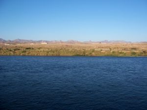
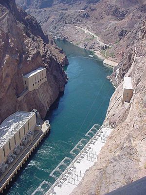
Below the confluence of the Virgin River of Nevada the Colorado abruptly turns southward. Hoover Dam, built during the Great Depression, forms Lake Mead, a popular recreation site as well as the supplier of most of the water for the city of Las Vegas. From Hoover Dam, the river flows south and forms part of the boundary between Arizona and Nevada and between Arizona and California. Along the California-Arizona reach of the river, four additional dams are operated to divert water for agricultural irrigation and for recreation. Lake Mohave, formed by Davis Dam, lies in the southern portion of the Lake Mead National Recreation Area. Lake Havasu, formed by Parker Dam, provides recreation as well as the home of the retired New London Bridge. The two remaining dams supply irrigation water: Palo Verde Diversion Dam and Imperial Dam. Here, the Colorado River ranges in width from 700 to 2500 feet (210 to 760 m) and from 8 to 100 feet in depth (2 to 30 m).
Below the Black Canyon the river lessens in gradient and in its lower course flows in a broad sedimentary valley's distinct estuarine plain upriver from Yuma, where it is joined by the Gila River. The channel through much of this region is bedded in a dike-like embankment lying above the floodplain over which the escaping water spills in time of flood. This dike cuts off the flow of the river to the remarkable low area in southern California known as the Salton Sink, Coachella Valley, or Imperial Valley. The Salton Sink is located below sea level; therefore, the descent from the river near Yuma is very much greater than the descent from Yuma to the gulf.
The lower course of the river, which forms the border between Baja California and Sonora, is essentially a trickle or a dry stream today due to use of the river as Imperial Valley's irrigation source. Prior to the mid 20th century, the Colorado River Delta provided a rich estuarine marshland that is now essentially desiccated, but nonetheless is an important ecological resource.
Elevation summary
Approximate heights above sea level at several key locations:
| Feet | Meters | Location |
| 9000 | 2750 | Colorado headwaters (Rocky Mountains) |
| 6100 | 1850 | midway to Colorado- Utah border |
| 4300 | 1300 | Colorado- Utah border |
| 3850 | 1170 | midway to Utah- Arizona border |
| 3700 | 1130 | Utah- Arizona border ( Wahweap Bay) |
| 3000 | 900 | midway to Grand Canyon ( Rider Point) |
| 2800 | 850 | Grand Canyon North Rim |
| 2500 | 760 | Grand Canyon South Rim |
| 1200 | 365 | Lake Mead (above Hoover Dam) |
| 600 | 183 | below Hoover Dam |
| 485 | 150 | California- Nevada- Arizona border |
| 100 | 30 | California- Arizona-Mexico border |
Note that the significant difference between the present height of the rim of the Grand Canyon (about 8000 ft; 2440 m) and the levels at which the river enters/exits it gives rise to the geologic theory that its upheaval must have begun around the same time the river began flowing through it and eroding it (since rivers do not run uphill, it would have otherwise followed some other path around the upheaval). Estimates for the beginning of this erosion/upheaval process range from 5 to 70 million years ago.
Engineering
In the autumn of 1904, the river's waters escaped into a diversion canal a few miles below Yuma, Arizona, creating the New River and Alamo River. The rivers re-created in California a great inland sea in an area that it had frequently inundated before, for example, in 1884 and 1891, when it had for a time practically abandoned its former course through Mexican territory to the Sea of Cortez. However, it was effectively dammed in the early part of 1907 and returned to its normal course, from which, however, there was still much leakage to the Salton Sea. In July 1907, the permanent dam was completed. From the Black Canyon towards the sea the Colorado normally flows through a desert-like basin.
The Colorado River is a major and in some cases life-sustaining source of water for irrigation, drinking, and other uses by people living in the arid American southwest. Allocation of the river's water is governed by the Colorado River Compact. Several dams have been built along the Colorado River, beginning with Glen Canyon Dam near the Utah-Arizona border. Other dams include Hoover Dam, Parker Dam, Davis Dam, Palo Verde Diversion Dam, and Imperial Dam. Since the completion of the dams, the majority of the river in normal hydrologic years is diverted for agricultural and municipal water supply. The Colorado's last drops evaporate in the Sonoran Desert, miles before the river reaches the Gulf of California. Almost 90% of all water diverted from the river is for irrigation purposes. The All-American Canal is the largest irrigation canal in the world and carries a volume of water from 15,000 to 30,000 ft³/s (420 to 850 m³/s), making it larger in volume than New York's Hudson River. The canal's waters are used to irrigate the parched but fertile Imperial Valley, where several years can pass between measurable rainfalls. Hydrology transport models are used to assess management of the river's flow and water quality.
Hoover Dam (originally Boulder Dam, and the first dam of its type) was completed in 1936. Its impoundment of the river in the Mojave Desert creates Lake Mead, which provides water for irrigation and the generation of hydroelectric power.
Several cities such as Los Angeles, Las Vegas, San Bernardino, San Diego, Phoenix, and Tucson have aqueducts leading all the way back to the Colorado River. One such aqueduct is the Central Arizona Project ("CAP") canal, which was begun in the 1970s and finished in the 1990s. The canal begins at Parker Dam and runs all the way to Phoenix and then Tucson to supplement those cities' water needs.
The lower Colorado is navigable by moderate to large sized craft. The lower river from Davis Dam to Yuma is navigable by large paddlewheel boats and river barges, but commercial navigation on the river is unimportant because the river is cut off from the sea, making other means of transportation more efficient in the region. Before the railroads arrived, the lower Colorado River from the Sea to near present day Laughlin, Nevada was an important means of transportation via large steamers. Most of the rest of the river, excluding the rapids in the canyons, is navigable by small to moderate sized river craft and power boats.
Moab uranium tailings
Atlas Corporation operated a uranium mine in the area of Moab, Utah, just under three miles from downtown Moab. As a byproduct of mining activities, a ten-million-ton pile of radioactive tailings exists. The pile is located about 700-800 feet from the Colorado River. Although no pollution has been detected, proximity of the material to the watershed has been a concern. The Senate has authorized the U.S. Department of Energy to budget $22.8 million in 2007 to begin the project of moving the uranium tailings farther from the river. The plan is to move the pile 15-20 miles north and away from the river. The project is expected to be completed by 2017.
Wildlife
The Colorado River basin is home to fourteen native species of fish. Four are endemic and endangered: Colorado pikeminnow (formerly Colorado squawfish), razorback sucker, bonytail chub, and humpback chub. The Upper Colorado River Endangered Fish Recovery Program is a controversial effort by the US Fish and Wildlife Service, in conjunction with the Arizona Game and Fish Department, the Colorado Division Of Wildlife, and the Utah Department Of Wildlife to recover these endangered fish.
Fish Species
- Rainbow
- Largemouth Bass
- Striped Bass
- Crappie
- Sunfish
- Catfish (Channel)
- Carp
