Image:LocationWHLatinAmerica.png
From Wikipedia, the free encyclopedia
Size of this preview: 480 × 480 pixels
Full resolution (800 × 800 pixels, file size: 33 KB, MIME type: image/png)
Summary
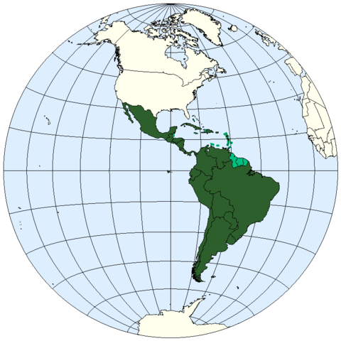
Western hemisphere map: Latin America. Countries in which Spanish or Portuguese is not the official language are in light green. Haiti however is considered a Latin American country in contrast to Jamaica for example, whose official language is English.
Lambert azimuthal projection. Adapted by E Pluribus Anthony from original image created by Marvin01 (Sean Baker) ( original data source) so its like not THAT big
Licensing
 |
I, the copyright holder of this work, hereby release it into the public domain. This applies worldwide. In case this is not legally possible, |
 |
This is a candidate to be copied to the Wikimedia Commons. Appropriately licensed media are more accessible to other Wikimedia projects if placed on Commons. Any user may perform this move - please see Moving images to the Commons for more information. Please remove this tag after this image has been copied to Commons. Copy to Commons via CommonsHelper |
File history
Click on a date/time to view the file as it appeared at that time.
| Date/Time | Dimensions | User | Comment | |
|---|---|---|---|---|
| current | 15:22, 23 April 2006 | 800×800 (33 KB) | E Pluribus Anthony ( Talk | contribs) | (Western hemisphere map: Latin America) |
| revert | 18:15, 20 February 2006 | 800×800 (33 KB) | E Pluribus Anthony ( Talk | contribs) | (Western hemisphere map: Latin America) |
See the setup instructions for more information.