Image:Ottawaexpands.png
From Wikipedia, the free encyclopedia
Size of this preview: 640 × 475 pixels
Full resolution (1,591 × 1,180 pixels, file size: 49 KB, MIME type: image/png)
| |
This is a file from the Wikimedia Commons. The description on its description page there is shown below. |
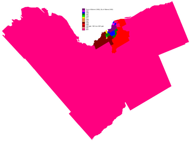
Originally uploaded to english wiki as en:Image:Ottawaexpands.png by creator en:User:Earl Andrew on November 25, 2004 This map shows the gradual incorporation of different municipalities into the city of Ottawa. Released by author to the public domain.
| Note: This tag is deprecated, please replace this template with {{ PD-user-w}} | |
 |
In case this is not legally possible: Earl Andrew grants anyone the right to use this work for any purpose, without any conditions, unless such conditions are required by law. |
File history
Click on a date/time to view the file as it appeared at that time.
| Date/Time | Dimensions | User | Comment | |
|---|---|---|---|---|
| current | 09:04, 1 May 2005 | 1,591×1,180 (49 KB) | Peregrine981 | (Originally uploaded to english wiki as en:Image:Ottawaexpands.png by creator en:User:Earl Andrew on November 25, 2004 This map shows the gradual incorporation of different municipalities into the city of Ottawa. Released by author to the public ) |
File links
The following pages on Schools Wikipedia link to this image (list may be incomplete):