Image:Houston Ship Channel Barbours Cut.jpg
From Wikipedia, the free encyclopedia
Size of this preview: 640 × 427 pixels
Full resolution (1,500 × 1,001 pixels, file size: 693 KB, MIME type: image/jpeg)
| |
This is a file from the Wikimedia Commons. The description on its description page there is shown below. |
| Description |
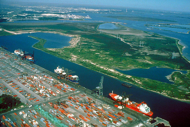
English: Aerial view of the Barbour's Cut area on the Houston Ship Channel in Houston, Texas, USA. This area is a large container terminal. This photograph appears to have been taken before the Fred Hartman Bridge was built, or when the bridge was under construction. In a present-day photograph, the bridge should be clearly visible at top right.
Coordinates: 29°40′54.98″N, 94°59′54.37″W |
|||
|---|---|---|---|---|
| Source |
U.S. Army Corps of Engineers Digital Visual Library |
|||
| Date |
Probably pre-1995 |
|||
| Author |
U.S. Army Corps of Engineers, photographer not specified or unknown |
|||
| Permission ( Reusing this image) |
|

File history
Click on a date/time to view the file as it appeared at that time.
| Date/Time | Dimensions | User | Comment | |
|---|---|---|---|---|
| current | 01:22, 10 May 2007 | 1,500×1,001 (693 KB) | DanMS | ({{Information | Description = {{en|Aerial view of the Barbour's Cut area on the Houston Ship Channel in Houston, Texas, USA. This area is a large container terminal. This photograph appears to have been taken before the Fred Hartman Bridge was built, o) |
File links
The following pages on Schools Wikipedia link to this image (list may be incomplete):