Image:Calgary street map.png
From Wikipedia, the free encyclopedia
Size of this preview: 386 × 479 pixels
Full resolution (960 × 1,192 pixels, file size: 802 KB, MIME type: image/png)
| |
This is a file from the Wikimedia Commons. The description on its description page there is shown below. |
Summary
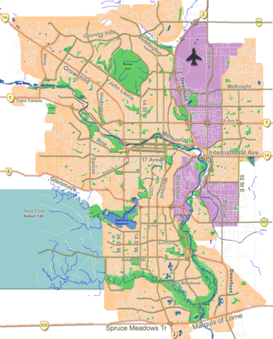
| Description |
Outline map of Calgary |
|---|---|
| Source |
GIS data |
| Date |
Aug 2006 |
| Author |
Qyd |
| Permission ( Reusing this image) |
All |
| Other versions | Image:CalgaryAB-map.png; Image:Calgary-CTrain stations.png (with C-Train track) |
| Camera location |
51°02′42″N, 114°03′26″W |
This and other geocoded Commons images: |
( Info) |
|---|
Licensing
 |
I, the copyright holder of this work, hereby release it into the public domain. This applies worldwide. In case this is not legally possible: Afrikaans | Alemannisch | Aragonés | العربية | Asturianu | Български | Català | Cebuano | Česky | Cymraeg | Dansk | Deutsch | Eʋegbe | Ελληνικά | English | Español | Esperanto | Euskara | Estremeñu | فارسی | Français | Galego | 한국어 | हिन्दी | Hrvatski | Ido | Bahasa Indonesia | Íslenska | Italiano | עברית | Kurdî / كوردی | Latina | Lietuvių | Latviešu | Magyar | Македонски | Bahasa Melayu | Nederlands | Norsk (bokmål) | Norsk (nynorsk) | 日本語 | Polski | Português | Ripoarisch | Română | Русский | Shqip | Slovenčina | Slovenščina | Српски / Srpski | Suomi | Svenska | ไทย | Tagalog | Türkçe | Українська | Tiếng Việt | Walon | 中文(简体) | 中文(繁體) | zh-yue-hant | +/- |
File history
Click on a date/time to view the file as it appeared at that time.
| Date/Time | Dimensions | User | Comment | |
|---|---|---|---|---|
| current | 18:31, 7 October 2007 | 960×1,192 (802 KB) | Qyd | (fix highway name) |
| 19:44, 18 April 2007 | 960×1,192 (791 KB) | Qyd | (spelling) | |
| 17:28, 18 September 2006 | 960×1,192 (792 KB) | Qyd | (outline industrial areas) | |
| 17:20, 16 August 2006 | 960×1,192 (802 KB) | Qyd | (added airport symbol and highway shields) | |
| 15:21, 14 August 2006 | 960×1,192 (797 KB) | Qyd | (fixed interchanges) | |
| 04:46, 14 August 2006 | 960×1,192 (700 KB) | Qyd | (added city parks) | |
| 04:19, 14 August 2006 | 960×1,192 (645 KB) | Qyd | (highways names added) | |
| 00:17, 14 August 2006 | 960×1,192 (491 KB) | Qyd | ({{Information |Description= Outline map of Calgary |Source=GIS data |Date=Aug 2006 |Author= Qyd |Permission=All |other_versions= Image:CalgaryAB-map.png }} Category:Calgary Category:Maps of cities in Canada) |
File links