Image:Denver satellite 1999.jpg
From Wikipedia, the free encyclopedia
Size of this preview: 640 × 480 pixels
Full resolution (1,440 × 1,080 pixels, file size: 409 KB, MIME type: image/jpeg)
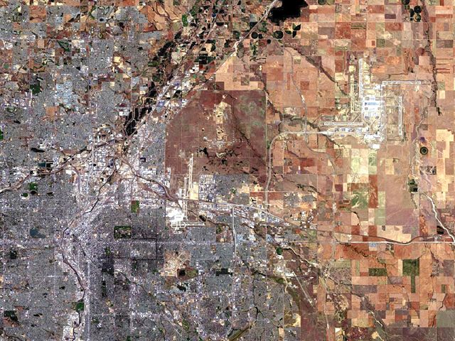
This is a satellite picture taken in 1999 of the northeast Denver metro area by NASA'a Landsat 7 Project. Since it is a government photo, it is in the public domain. The website where the photo is from is at: http://landsat.gsfc.nasa.gov/data/Browse/Cities/denver.html
 |
This file is in the public domain because it was created by NASA. NASA copyright policy states that "NASA material is not protected by copyright unless noted". ( NASA copyright policy page or JPL Image Use Policy)
|
File history
Click on a date/time to view the file as it appeared at that time.
| Date/Time | Dimensions | User | Comment | |
|---|---|---|---|---|
| current | 06:04, 18 May 2005 | 1,440×1,080 (409 KB) | Vertigo700 ( Talk | contribs) | (This is a satellite picture taken in 1999 of the Denver metro area by NASA'a Landsat 7 Project. Since it is a government photo, it is in the public domain. The website where the photo is from is at: http://landsat.gsfc.nasa.gov/data/Browse/Cities/denve) |
See the setup instructions for more information.
File links
The following pages on Schools Wikipedia link to this image (list may be incomplete):
Categories: NASA images | Images of Denver