Image:IsleOfMan SheadingsAndParishes-en.svg
From Wikipedia, the free encyclopedia
IsleOfMan_SheadingsAndParishes-en.svg (SVG file, nominally 1,200 × 1,100 pixels, file size: 222 KB)
| |
This is a file from the Wikimedia Commons. The description on its description page there is shown below. |
| Description |
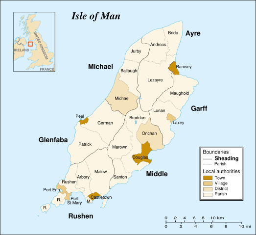
Map in english of the Isle of Man, with bounds of sheadings, towns, villages, districts and parishes. |
|---|---|
| Source |
Own work. Based on maps Image:Isle of Man map-fr.svg, Image:Isle_of_Man_cities_villages.png and Image:Isle_of_Man_parishes_by_sheading.png. |
| Date |
2007-05-28 |
| Author |
Sémhur |
| Permission ( Reusing this image) |
see below |
| Other versions |
Français : Image:IsleOfMan_SheadingsAndParishes-fr.svg |
 |
This SVG file uses embedded text that can be easily translated into your language. Learn more. For SVG images, you can use this page to translate it into your language. العربية | Català | Dansk | Deutsch | English | Esperanto | Español | Français | Galego | Italiano | 日本語 | Lietuvių | Magyar | Nederlands | Polski | Português | Русский | Svenska | Українська | +/- |
Licensing
|

File history
Click on a date/time to view the file as it appeared at that time.
| Date/Time | Dimensions | User | Comment | |
|---|---|---|---|---|
| current | 12:48, 17 January 2008 | 1,200×1,100 (222 KB) | Sémhur | (Update) |
| 20:36, 29 May 2007 | 1,200×1,100 (356 KB) | Sémhur | ({{Information |Description=Map in english of the Isle of Man, with bounds of sheadings, towns, villages, districts and parishes. |Source=Own work. Based on maps Image:Isle of Man map-fr.svg, [[:Image:Isle_of_Man_cities_villages.pn) |