Image:Chile.estrechodemagallanes.png
From Wikipedia, the free encyclopedia
Size of this preview: 640 × 421 pixels
Full resolution (2,111 × 1,389 pixels, file size: 767 KB, MIME type: image/png)
| |
This is a file from the Wikimedia Commons. The description on its description page there is shown below. |
| Description |
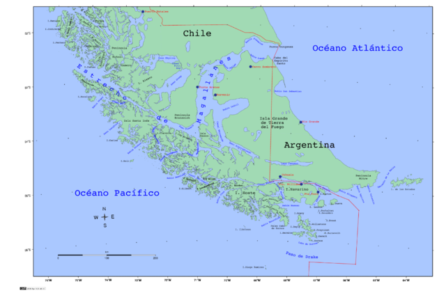
Strait of Magellan, Chile |
|||
|---|---|---|---|---|
| Source |
self-made |
|||
| Date |
2008 |
|||
| Author |
Createaccount |
|||
| Permission ( Reusing this image) |
|

File history
Click on a date/time to view the file as it appeared at that time.
| Date/Time | Dimensions | User | Comment | |
|---|---|---|---|---|
| current | 01:54, 11 April 2008 | 2,111×1,389 (767 KB) | Createaccount | ({{Information |Description=Strait of Magellan, Chile |Source=self-made |Date=2008 |Author= Createaccount |Permission={{GFDL-GMT}} |other_versions= }} Category:Strait of Magellan Category:Maps of Chile) |
File links
The following pages on Schools Wikipedia link to this image (list may be incomplete):