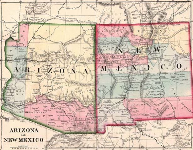
Image:AZ-NM1867.jpg
From Wikipedia, the free encyclopedia
Size of this preview: 615 × 479 pixels
Full resolution (621 × 484 pixels, file size: 97 KB, MIME type: image/jpeg)
| |
This is a file from the Wikimedia Commons. The description on its description page there is shown below. |
| Description |
Historic Map of Arizona and New Mexico. |
|||||||
|---|---|---|---|---|---|---|---|---|
| Source |
Transferred from en.wikipedia by Wars on 19 May 2007 (UTC) under the {{ PD-US}} license tag. |
|||||||
| Date |
1867 |
|||||||
| Author |
Wars 07:04, 19 May 2007 (UTC) |
|||||||
| Permission ( Reusing this image) |
|

File history
Click on a date/time to view the file as it appeared at that time.
| Date/Time | Thumbnail | Dimensions | User | Comment | |
|---|---|---|---|---|---|
| current | 10:30, 23 March 2008 |  |
621×484 (97 KB) | Finavon | (border cropped) |
| 07:04, 19 May 2007 |  |
750×615 (144 KB) | Wars | (The image was transferred from en.wiki { en:Image:AZ-NM1867.jpg) under the '''<nowiki>{{PD-US}}</nowiki>''' license tag. ~~~~) |
File links
The following pages on Schools Wikipedia link to this image (list may be incomplete):