Image:Volgarivermap.png
From Wikipedia, the free encyclopedia
Size of this preview: 480 × 480 pixels
Full resolution (500 × 500 pixels, file size: 155 KB, MIME type: image/png)
| |
This is a file from the Wikimedia Commons. The description on its description page there is shown below. |
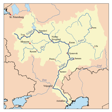
This is a map of the Volga River system. I, Karl Musser, created it based on USGS data.
|
File history
Click on a date/time to view the file as it appeared at that time.
| Date/Time | Dimensions | User | Comment | |
|---|---|---|---|---|
| current | 17:06, 23 July 2007 | 500×500 (155 KB) | Kmusser | (Ural river fix) |
| 14:50, 17 October 2006 | 500×500 (40 KB) | Kmusser | ||
| 20:15, 31 August 2006 | 500×500 (126 KB) | Kmusser | (This is a map of the Volga River system. I, Karl Musser, created it based on USGS data. {{self|cc-by-sa-2.5}} Category:Maps of rivers) |
File links
The following pages on Schools Wikipedia link to this image (list may be incomplete):