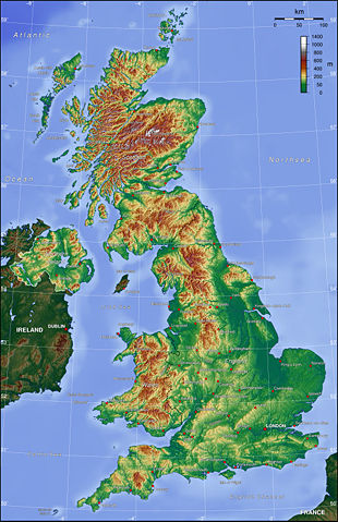
Image:Uk topo en.jpg
From Wikipedia, the free encyclopedia
Size of this preview: 310 × 479 pixels
Full resolution (2,000 × 3,089 pixels, file size: 1.65 MB, MIME type: image/jpeg)
| |
This is a file from the Wikimedia Commons. The description on its description page there is shown below. |
 |
Permission is granted to copy, distribute and/or modify this map under the terms of the GNU Free Documentation License, Version 1.2 or any later version published by the Free Software Foundation; with no Invariant Sections, no Front-Cover Texts, and no Back-Cover Texts. A copy of the license is included in the section entitled " GNU Free Documentation License". The map has been created with the Generic Mapping Tools: http://gmt.soest.hawaii.edu/ using one or more of these public domain datasets for the relief:
|
|
File history
Click on a date/time to view the file as it appeared at that time.
| Date/Time | Dimensions | User | Comment | |
|---|---|---|---|---|
| current | 17:42, 26 October 2006 | 2,000×3,089 (1.65 MB) | Conscious | (Reverted to earlier revision) |
| 17:42, 26 October 2006 | 1,400×1,670 (597 KB) | Conscious | (version from en:, same author) | |
| 22:06, 7 July 2006 | 2,000×3,089 (1.65 MB) | Captain Blood | ({{Bild-GFDL-GMT}} ) |
File links
The following pages on Schools Wikipedia link to this image (list may be incomplete):