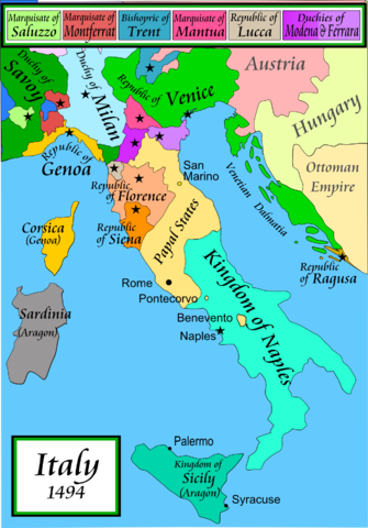
Image:Italy 1494 v2.png
From Wikipedia, the free encyclopedia
Size of this preview: 335 × 480 pixels
Full resolution (1,261 × 1,805 pixels, file size: 539 KB, MIME type: image/png)
| |
This is a file from the Wikimedia Commons. The description on its description page there is shown below. |
Contents |
Summary
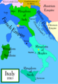
Political map of Italy in early 1494, before the invasion of Italy by Charles VIII of France, created by MapMaster.
Part of a series of maps on the history of Italy:
 1000 AD |
 1084 AD |
 1796 AD |
 1810 AD |
Versions
- English
References
- Bjorklund, Oddvar; Holmboe, Haakon; Rohr, Anders (1970) Historical Atlas of the World, Barnes & Noble, NY, SBN: 389-00253-4.
- Matthew, Donald, (1983), Atlas of Medieval Europe, Checkmark Books, New York.
- Online maps, including this 1882 map from Shepherd (the University of Texas)
Licensing
|

File history
Click on a date/time to view the file as it appeared at that time.
| Date/Time | Dimensions | User | Comment | |
|---|---|---|---|---|
| current | 22:04, 14 April 2007 | 1,261×1,805 (539 KB) | MapMaster | (Minor modifications) |
| 16:07, 27 February 2007 | 1,167×1,642 (471 KB) | MapMaster | (Modification suggested by User:Paolo da Reggio) | |
| 23:52, 8 January 2007 | 1,135×1,625 (472 KB) | MapMaster | (Political map of Italy in early 1494, before the invasion of Italy by Charles VIII of France, created by MapMaster. ) |