Image:Lichtenstein NASA.png
From Wikipedia, the free encyclopedia
Size of this preview: 640 × 421 pixels
Full resolution (992 × 653 pixels, file size: 1.29 MB, MIME type: image/png)
| |
This is a file from the Wikimedia Commons. The description on its description page there is shown below. |
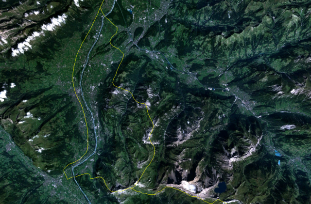
satellite image of Liechtenstein with wrong yellow boundary. In reality left boundary is on the Rhein. See map from CIA Factbook.
 |
This image is in the public domain because it is a screenshot from NASA’s globe software World Wind using Blue Marble, Landsat or USGS layer, all of which are in public domain. |
|
File history
Click on a date/time to view the file as it appeared at that time.
| Date/Time | Dimensions | User | Comment | |
|---|---|---|---|---|
| current | 03:18, 21 March 2006 | 992×653 (1.29 MB) | Roke | (satellite image of Lichtenstein {{PD-WorldWind}} Category: Lichtenstein) |
File links
The following pages on Schools Wikipedia link to this image (list may be incomplete):