Image:LocationBahrain.png
From Wikipedia, the free encyclopedia
No higher resolution available.
LocationBahrain.png (250 × 115 pixels, file size: 5 KB, MIME type: image/png)
| |
This is a file from the Wikimedia Commons. The description on its description page there is shown below. |
 |
This image has been (or is hereby) released into the public domain by its creator, Vardion. This applies worldwide. In case this is not legally possible, the creator grants anyone the right to use this work for any purpose, without any conditions, unless such conditions are required by law. |
Image:Ba-map.gif
 |
This map image should be recreated using vector graphics as an SVG file. This has several advantages; see Commons:Media for cleanup for more information. If an SVG form of this image is already available, please upload it. After uploading an SVG, replace this template with {{ vector version available|new image name.svg}}. |
|
العربية | Български | Català | Česky | Dansk | Deutsch | English | Esperanto | Español | Français | Galego | 한국어 | Italiano | Magyar | Lietuvių | Nederlands | 日本語 | Polski | Português | Română | Русский | Suomi | Svenska | Türkçe | Українська | 中文(繁體) | 中文(简体) | +/- |
|
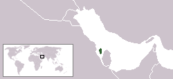
Location map for the Bahrain.
Originally created for English Wikipedia by Vardion.
 |
This image has been (or is hereby) released into the public domain by its author, Vardion at the English Wikipedia project. This applies worldwide. In case this is not legally possible: |
File history
Click on a date/time to view the file as it appeared at that time.
| Date/Time | Dimensions | User | Comment | |
|---|---|---|---|---|
| current | 15:24, 14 December 2004 | 250×115 (5 KB) | EugeneZelenko | (Location map for the Bahrain.<br/>Originally created for English Wikipedia by Vardion.<br/>{{PD}}<br/> Category:Country locator maps) |