Image:States of Brazil.svg

From Wikipedia, the free encyclopedia

States_of_Brazil.svg‎ (SVG file, nominally 780 × 687 pixels, file size: 667 KB)

Wikimedia Commons logo This is a file from the Wikimedia Commons. The description on its description page there is shown below.
Commons is a freely licensed media file repository. You can help.
This image was created / taken by João Felipe C.S.   pt   en   es   it   fr   de
Description
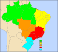
English: Brazilian states numered map.
Português: Mapa numerado dos estados Brasileiros.

This vector image was created with Inkscape.
Source

Own work ( Image:Brazil State Map.svg)

Date

March 12, 2008

Author

João Felipe C.S

Permission
( Reusing this image)
I, João Felipe C.S, the copyright holder of this work, has published or hereby publishes it under the following licenses:
GNU head Permission is granted to copy, distribute and/or modify this document under the terms of the GNU Free Documentation license, Version 1.2 or any later version published by the Free Software Foundation; with no Invariant Sections, no Front-Cover Texts, and no Back-Cover Texts. A copy of the license is included in the section entitled " GNU Free Documentation license".

Aragonés | العربية | Asturianu | Беларуская (тарашкевіца) | Български | বাংলা | ইমার ঠার/বিষ্ণুপ্রিয়া মণিপুরী | Brezhoneg | Bosanski | Català | Cebuano | Česky | Dansk | Deutsch | Ελληνικά | English | Esperanto | Español | Eesti | Euskara | فارسی | Suomi | Français | Gaeilge | Galego | עברית | Hrvatski | Magyar | Bahasa Indonesia | Ido | Íslenska | Italiano | 日本語 | ქართული | ភាសាខ្មែរ | 한국어 | Kurdî / كوردی | Latina | Lëtzebuergesch | Lietuvių | Bahasa Melayu | Nnapulitano | Nederlands | ‪Norsk (nynorsk)‬ | ‪Norsk (bokmål)‬ | Occitan | Polski | Português | Română | Русский | Slovenčina | Slovenščina | Shqip | Српски / Srpski | Svenska | తెలుగు | ไทย | Tagalog | Türkçe | Українська | اردو | Tiếng Việt | Volapük | Yorùbá | ‪中文(简体)‬ | ‪中文(繁體)‬ | +/-

Some rights reserved
Creative Commons Attribution icon Creative Commons Share Alike icon
This file is licensed under the Creative Commons Attribution ShareAlike license versions 2.5, 2.0, and 1.0

العربية | Български | Català | Česky | Dansk | Deutsch | English | Español | Euskara | فارسی | Français | Galego | עברית | Italiano | 日本語 | 한국어 | Lietuvių | Nederlands | Polski | Português | Русский | Svenska | தமிழ் | తెలుగు | Türkçe | 中文 | 中文 | +/-

You may select the license of your choice.
Other versions

File history

Click on a date/time to view the file as it appeared at that time.

Date/Time Dimensions User Comment
current 21:53, 12 March 2008 780×687 (667 KB) João Felipe C.S ({{Information |Description= |Source= |Date= |Author= |Permission= |other_versions= }} )
21:42, 12 March 2008 780×687 (667 KB) João Felipe C.S ({{User:João Felipe C.S/by}} {{Information |Description= {{en|Brazilian states numered map.}} {{pt|Mapa numerado dos estados Brasileiros.}} ---- {{Inkscape}} |Source= Own work ( Image:Brazil State Map.svg) |Date= March 12, 2008 |Author= {{User:João )
The following pages on Schools Wikipedia link to this image (list may be incomplete):
The Schools Wikipedia is sponsored by SOS Children , and is mainly selected from the English Wikipedia with only minor checks and changes (see www.wikipedia.org for details of authors and sources). See also our Disclaimer.