Image:SAP Kosovo.png
From Wikipedia, the free encyclopedia
Size of this preview: 548 × 480 pixels
Full resolution (941 × 824 pixels, file size: 15 KB, MIME type: image/png)
| |
This is a file from the Wikimedia Commons. The description on its description page there is shown below. |
Summary
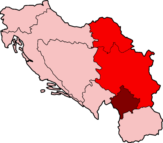
| Description |
Map of the Kosovo Socialist Autonomous Province of the Socialist Republic of Serbia under the Socialist Federal Republic of Yugoslavia |
|---|---|
| Source |
Based on SFRYugoslaviaNumbered.png. |
| Date |
2007-06-07 |
| Author |
Based on map originally created by w:en:User:Morwen. Modified by w:en:User:Aivazovsky. |
| Permission ( Reusing this image) |
GFDL |
| Other versions | Image:SFRYugoslaviaNumbered.png |
Licensing
|

File history
Click on a date/time to view the file as it appeared at that time.
| Date/Time | Dimensions | User | Comment | |
|---|---|---|---|---|
| current | 23:45, 29 January 2008 | 941×824 (15 KB) | Mahahahaneapneap | (pngcrushed) |
| 18:53, 7 June 2007 | 941×824 (21 KB) | Aivazovsky | (== Summary == {{Information |Description=Map of the Kosovo Socialist Autonomous Province of the Socialist Republic of Serbia under the Socialist Federal Republic of Yugoslavia |Source=Based on SFRYugoslaviaNumbered.png) |