Image:Oregon county pop 2007.png
From Wikipedia, the free encyclopedia
Size of this preview: 590 × 479 pixels
Full resolution (1,600 × 1,300 pixels, file size: 117 KB, MIME type: image/png)
Summary
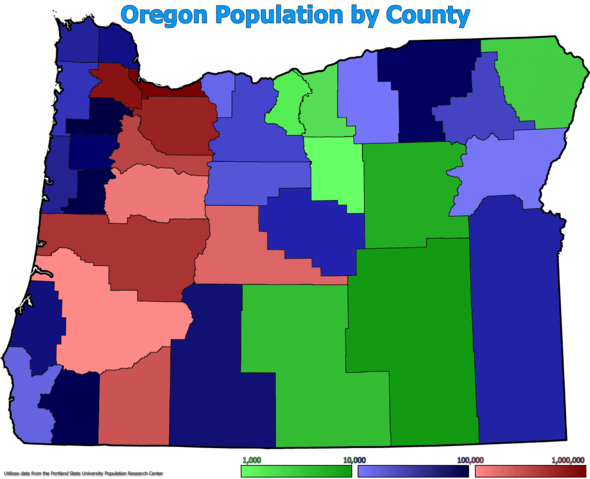
I (Brian Zablocky) created this image myself using Fireworks MX 2004 and data from the Portland State University Population Research Centre.
The original graphic was Image:Map of Oregon highlighting Crook County.svg by User:Dbenbenn
Licensing
|
File history
Click on a date/time to view the file as it appeared at that time.
| Date/Time | Dimensions | User | Comment | |
|---|---|---|---|---|
| current | 09:13, 3 March 2008 | 1,600×1,300 (117 KB) | ZabMilenko ( Talk | contribs) | (I (Brian Zablocky) created this image myself using Fireworks MX 2004 and data from the Portland State University Population Research Centre. The original graphic was Image:Map of Oregon highlighting Crook County.svg by User:Dbenbenn ) |
See the setup instructions for more information.
File links
The following pages on Schools Wikipedia link to this image (list may be incomplete):
Categories: Creative Commons Attribution-ShareAlike 3.0 images | GFDL images | Self-published work