Image:Map of Oregon NA.png
From Wikipedia, the free encyclopedia
Size of this preview: 640 × 433 pixels
Full resolution (1,967 × 1,331 pixels, file size: 2.15 MB, MIME type: image/png)
| |
This is a file from the Wikimedia Commons. The description on its description page there is shown below. |
| Description |
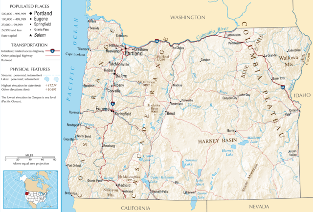
Map of Oregon |
|---|---|
| Source |
National Atlas |
| Date | |
| Author | |
| Permission ( Reusing this image) |
see below
|
 |
This map was obtained from an edition of the National Atlas of the United States. Like almost all works of the U.S. federal government, works from the National Atlas are in the public domain. Online access: NationalAtlas.gov | 1970 print edition: Library of Congress, Perry-Castañeda Library |
 |
File history
Click on a date/time to view the file as it appeared at that time.
| Date/Time | Dimensions | User | Comment | |
|---|---|---|---|---|
| current | 05:46, 16 October 2007 | 1,967×1,331 (2.15 MB) | Peteforsyth | (removed extraneous text and logo from public domain image) |
| 08:13, 15 August 2006 | 2,122×1,640 (2.75 MB) | Huebi | ({{Information| |Description=Map of Oregon |Source=[http://www.nationalatlas.gov National Atlas] }} Category:Maps of the United States Category:Maps of Oregon {{PD-USGov-Atlas}}) |
File links
The following pages on Schools Wikipedia link to this image (list may be incomplete):