Image:San Jose California aerial view south.jpg
From Wikipedia, the free encyclopedia
Size of this preview: 640 × 427 pixels
Full resolution (1,500 × 1,000 pixels, file size: 785 KB, MIME type: image/jpeg)
| |
This is a file from the Wikimedia Commons. The description on its description page there is shown below. |
| Description |
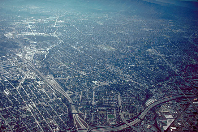
English: Aerial view of San José, California, USA. The intersection of Interstate-280 and California State Route 87 (Guadalupe Parkway) is visible at the bottom of the photograph. View is to the south.
Coordinates: 37°19′7.84″N, 121°53′35.92″W |
|||
|---|---|---|---|---|
| Source |
U.S. Army Corps of Engineers Digital Visual Library |
|||
| Date |
not specified or unknown |
|||
| Author |
Robert Campbell, U.S. Army Corps of Engineers |
|||
| Permission ( Reusing this image) |
|

File history
Click on a date/time to view the file as it appeared at that time.
| Date/Time | Dimensions | User | Comment | |
|---|---|---|---|---|
| current | 05:04, 3 May 2007 | 1,500×1,000 (785 KB) | DanMS | ({{Information | Description = {{en|Aerial view of San José, California, USA. The intersection of Interstate-280 and California State Route 87 (Guadalupe Parkway) is visible at the bottom of the photograph. View is to the south.}} Coordinates: {{Coor ) |
File links
The following pages on Schools Wikipedia link to this image (list may be incomplete):