Image:Rico.png
From Wikipedia, the free encyclopedia
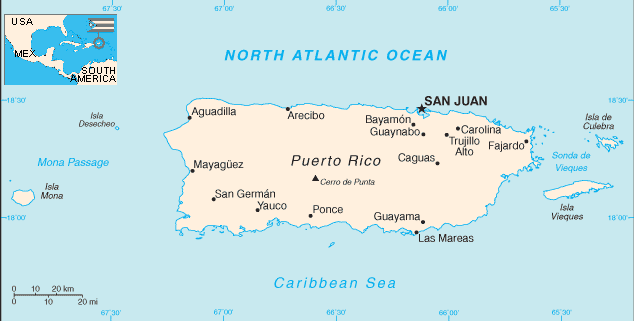
Map of Puerto Rico. Modified to add inset.
 |
This image is a map or flag taken and/or modified from the Central Intelligence Agency's World Factbook. Under United States copyright law, all information and images from the World Factbook are in the public domain. | |
myjnkjfnvkjnvjf r from prpowkrofkkfmjq2er
|
|
The Wikimedia Commons has another file with the same name as this file. To include the Commons media file in Wikipedia, this locally stored file needs to be renamed. | |
File history
Click on a date/time to view the file as it appeared at that time.
| Date/Time | Dimensions | User | Comment | |
|---|---|---|---|---|
| current | 04:50, 19 February 2007 | 634×321 (15 KB) | Hoshie ( Talk | contribs) | (Updated version using the latest CIA Factbook map with the inset readded) |
| revert | 01:11, 20 June 2005 | 557×263 (9 KB) | Ikescs ( Talk | contribs) | (Reverted to earlier revision) |
| revert | 01:11, 20 June 2005 | 514×300 (8 KB) | Ikescs ( Talk | contribs) | (Reverted to earlier revision) |
| revert | 03:59, 22 April 2003 | 557×263 (9 KB) | Hfastedge ( Talk | contribs) | (Reverted to earlier revision) |
| revert | 08:30, 21 April 2003 | 514×300 (8 KB) | Hfastedge ( Talk | contribs) | (Reverted to earlier revision) |
| revert | 14:59, 19 April 2003 | 557×263 (9 KB) | Hfastedge ( Talk | contribs) | (Used cia wfb map, and added inset, did some movement of text) |
| revert | 09:56, 22 July 2002 | 514×300 (8 KB) | Caltrop ( Talk | contribs) |
See the setup instructions for more information.
File links
The following pages on Schools Wikipedia link to this image (list may be incomplete):
Categories: CIA World Factbook images | Maps of Puerto Rico