Image:Map hamburg 1800.png
From Wikipedia, the free encyclopedia
Size of this preview: 517 × 479 pixels
Full resolution (854 × 792 pixels, file size: 390 KB, MIME type: image/png)
| |
This is a file from the Wikimedia Commons. The description on its description page there is shown below. |
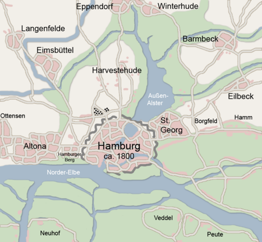
own drawing from atlas town of hamburg an surrounding app. 1800
| |
This file is licensed under the Creative Commons Attribution ShareAlike 2.5 License. In short: you are free to share and make derivative works of the file under the conditions that you appropriately attribute it, and that you distribute it only under a license identical to this one. Official license |
 |
Permission is granted to copy, distribute and/or modify this document under the terms of the GNU Free Documentation license, Version 1.2 or any later version published by the Free Software Foundation; with no Invariant Sections, no Front-Cover Texts, and no Back-Cover Texts. A copy of the license is included in the section entitled " GNU Free Documentation license". Aragonés | العربية | Asturianu | Беларуская (тарашкевіца) | Български | বাংলা | ইমার ঠার/বিষ্ণুপ্রিয়া মণিপুরী | Brezhoneg | Bosanski | Català | Cebuano | Česky | Dansk | Deutsch | Ελληνικά | English | Esperanto | Español | Eesti | Euskara | فارسی | Suomi | Français | Gaeilge | Galego | עברית | Hrvatski | Magyar | Bahasa Indonesia | Ido | Íslenska | Italiano | 日本語 | ქართული | ភាសាខ្មែរ | 한국어 | Kurdî / كوردی | Latina | Lëtzebuergesch | Lietuvių | Bahasa Melayu | Nnapulitano | Nederlands | Norsk (nynorsk) | Norsk (bokmål) | Occitan | Polski | Português | Română | Русский | Slovenčina | Slovenščina | Shqip | Српски / Srpski | Svenska | తెలుగు | ไทย | Tagalog | Türkçe | Українська | اردو | Tiếng Việt | Volapük | Yorùbá | 中文(简体) | 中文(繁體) | +/- |
File history
Click on a date/time to view the file as it appeared at that time.
| Date/Time | Dimensions | User | Comment | |
|---|---|---|---|---|
| current | 15:12, 17 February 2007 | 854×792 (390 KB) | Flor!an | ({{Information |Description= Karte von Hamburg und Umgebung ca. 1800 |Source= own work |Date=17.02.2007 |Author= |other_versions= }} Alte Version nachgezeichnet, dezentere Farben verwendet.) |
| 18:14, 4 June 2005 | 854×792 (56 KB) | Ctsu | ({{PD}} created myself from atlas) | |
| 17:28, 2 June 2005 | 854×792 (55 KB) | Ctsu | (own creation from atlas) | |
| 19:33, 1 June 2005 | 854×792 (53 KB) | Ctsu | (own creation from atlas) | |
| 19:28, 1 June 2005 | 854×792 (53 KB) | Ctsu | (own drawing from atlas) |