Image:Tropical Cyclone 2B (2000).jpg
From Wikipedia, the free encyclopedia
Size of this preview: 493 × 479 pixels
Full resolution (600 × 583 pixels, file size: 82 KB, MIME type: image/jpeg)
| |
This is a file from the Wikimedia Commons. The description on its description page there is shown below. |
Summary
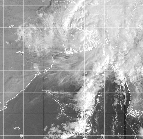
| Description |
This satellite image shows Tropical Cyclone 2B near its Bangladesh landfall in October of 2000 at 0131 UTC. Despite its disorganized nature, the storm caused 25 deaths from heavy flooding. |
|||
|---|---|---|---|---|
| Source |
http://metocph.nmci.navy.mil/jtwc/atcr/2000atcr/ch1/chap1_page41.html |
|||
| Date |
2000-10-28 |
|||
| Author |
Joint Typhoon Warning Centre |
|||
| Permission ( Reusing this image) |
|


File history
Click on a date/time to view the file as it appeared at that time.
| Date/Time | Dimensions | User | Comment | |
|---|---|---|---|---|
| current | 15:49, 27 December 2005 | 600×583 (82 KB) | Hurricanehink | (From https://metoc.npmoc.navy.mil/jtwc/atcr/2000atcr/ch1/chap1_page41.html, this satellite image shows Tropical Cyclone 2B near its Bangladesh landfall in October of 2000. Despite its disorganized nature, the storm caused 25 deaths from heavy flooding. {) |
File links
The following pages on Schools Wikipedia link to this image (list may be incomplete):