Image:GDRTHornR2.png
From Wikipedia, the free encyclopedia
Size of this preview: 640 × 455 pixels
Full resolution (647 × 460 pixels, file size: 149 KB, MIME type: image/png)
Summary
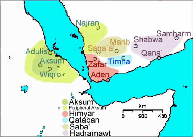
Created by me ( Yom). Map of Horn of Africa and South Arabia at the end of GDRT's reign, ca. 230 AD.
Licensing
| |
I, the creator of this work, hereby grant the permission to copy, distribute and/or modify this document under the terms of the GNU Free Documentation License, Version 1.2 or any later version published by the Free Software Foundation; with no Invariant Sections, no Front-Cover Texts, and no Back-Cover Texts. Subject to disclaimers. |
File history
Click on a date/time to view the file as it appeared at that time.
| Date/Time | Dimensions | User | Comment | |
|---|---|---|---|---|
| current | 09:41, 15 July 2006 | 647×460 (149 KB) | Yom ( Talk | contribs) | (Created by me ( Yom). Map of Horn of Africa and South Arabia at the end of GDRT's reign, ca. 230 AD.) |
| revert | 09:22, 15 July 2006 | 647×460 (142 KB) | Yom ( Talk | contribs) | (Created by me ( Yom). Map of Horn of Africa and South Arabia at the end of [[GDRT's reign, ca. 230 AD. ) |
See the setup instructions for more information.
File links
The following pages on Schools Wikipedia link to this image (list may be incomplete):
Categories: Self-published work