Image:Katrina-noaaGOES12.jpg
From Wikipedia, the free encyclopedia
Size of this preview: 640 × 400 pixels
Full resolution (1,919 × 1,198 pixels, file size: 1.13 MB, MIME type: image/jpeg)
| |
This is a file from the Wikimedia Commons. The description on its description page there is shown below. |
| Description |
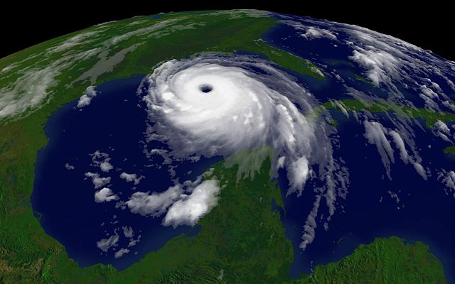
Courtesy NOAA/NESDIS: http://www.nnvl.noaa.gov/ 2005/08/28T1515Z |
||||
|---|---|---|---|---|---|
| Source |
http://www.nnvl.noaa.gov/hurseas2005/Katrina1515z-050828-4kg12.jpg as linked by http://www.nnvl.noaa.gov/cgi-bin/index.cgi?page=items&ser=109660&large=1 |
||||
| Date |
2005-08-28 |
||||
| Author |
NOAA |
||||
| Permission ( Reusing this image) |
see below
|
 |
This image is in the public domain because it contains materials that originally came from the U.S. National Oceanic and Atmospheric Administration, taken or made during the course of an employee's official duties. |
 |
File history
Click on a date/time to view the file as it appeared at that time.
| Date/Time | Dimensions | User | Comment | |
|---|---|---|---|---|
| current | 09:11, 23 July 2007 | 1,919×1,198 (1.13 MB) | Jeff G. | (Larger version from http://www.nnvl.noaa.gov/hurseas2005/Katrina1515z-050828-4kg12.jpg as linked by http://www.nnvl.noaa.gov/cgi-bin/index.cgi?page=items&ser=109660&large=1) |
| 15:17, 3 September 2005 | 642×482 (39 KB) | Square87 |
File links
The following pages on Schools Wikipedia link to this image (list may be incomplete):