Image:Location-Austria-Hungary-01.png
From Wikipedia, the free encyclopedia
Size of this preview: 640 × 440 pixels
Full resolution (805 × 553 pixels, file size: 12 KB, MIME type: image/png)
| |
This is a file from the Wikimedia Commons. The description on its description page there is shown below. |
 |
This map image should be recreated using vector graphics as an SVG file. This has several advantages; see Commons:Media for cleanup for more information. If an SVG form of this image is already available, please upload it. After uploading an SVG, replace this template with {{ vector version available|new image name.svg}}. |
|
العربية | Български | Català | Česky | Dansk | Deutsch | English | Esperanto | Español | Français | Galego | 한국어 | Italiano | Magyar | Lietuvių | Nederlands | 日本語 | Polski | Português | Română | Русский | Suomi | Svenska | Türkçe | Українська | 中文(繁體) | 中文(简体) | +/- |
|
 |
This map has been uploaded by Electionworld from en.wikipedia.org to enable the |
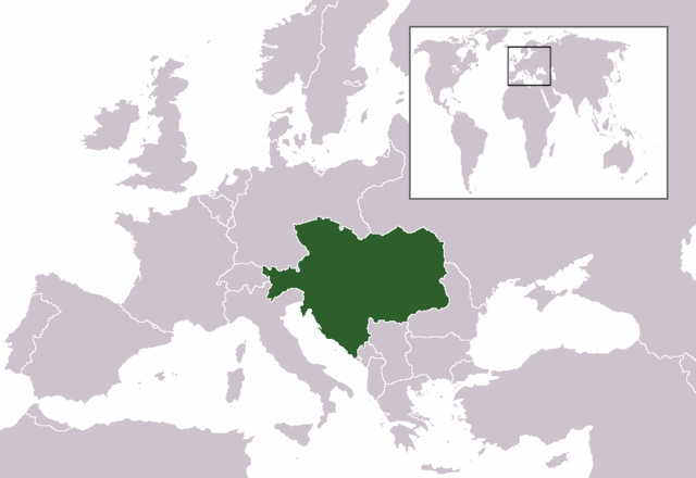
Location map: Austria-Hungary (ca 1913)
Created by Georgi Banchev.
 |
This image has been released into the public domain by its author, cassini83. This applies worldwide. In some countries this may not be legally possible; if so: العربية | Български | Deutsch | Ελληνικά | English | Español | Français | Italiano | 日本語 | 한국어 | Polski | Русский | Српски / Srpski | Svenska | தமிழ் | Українська | 中文(繁體) | 中文(简体) +/- |
File history
Click on a date/time to view the file as it appeared at that time.
| Date/Time | Dimensions | User | Comment | |
|---|---|---|---|---|
| current | 11:37, 16 July 2007 | 805×553 (12 KB) | Nihad Hamzic | (Greatly reduced image size by losslessly reducing colour domain.) |
| 22:46, 23 December 2006 | 805×553 (33 KB) | Electionworld | ({{ew|en|Cassini83}} Location map: Austria-Hungary (ca 1913) Created by Georgi Banchev. {{PD-user|cassini83}} Category:Maps of Austria-Hungary ) |