Tropic of Capricorn
2008/9 Schools Wikipedia Selection. Related subjects: Geography
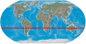
The Tropic of Capricorn, or Southern tropic, is one of the five major circles of latitude that mark maps of the Earth. It lies 23° 26′ 22″ south of the Equator, and marks the most southerly latitude at which the sun can appear directly overhead at noon. This event occurs at the December solstice, when the southern hemisphere is tilted towards the sun to its maximum extent.
The northern hemisphere equivalent of the Tropic of Capricorn is the Tropic of Cancer. Schoolchildren are sometimes taught to remember which tropic is which by the fact that Cancer has the letter N, for North, in the middle of it. Alternatively: corns grow on the feet (i.e. the lower part of the body, corresponding to the southern hemisphere). Latitudes south of the Tropic of Capricorn are in the Southern Temperate Zone. The region north of the Tropic of Capricorn and south of the Tropic of Cancer is known as the Tropics.
The Tropic of Capricorn is so named because about 2,000 years ago the sun was entering the constellation Capricornus (capricorn is Latin for goat horn) at the December solstice. In modern times the sun appears in the constellation Sagittarius during this time. The change is due to precession of the equinoxes. The word "tropic" itself comes from the Greek tropos, meaning turn, referring to the fact that the sun appears to "turn back" at the solstices.
The position of the Tropic of Capricorn is not fixed, but varies in a complex manner over time; see under circles of latitude for information.
Geography

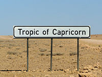
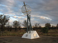
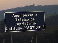
Starting at the Prime Meridian and heading eastwards, the Tropic of Capricorn passes through:
-
Country, territory or sea Notes Atlantic Ocean  Namibia
 Botswana
 South Africa
 Mozambique
Indian Ocean Mozambique Channel  Madagascar
Indian Ocean  Australia
Western Australia
Northern Territory
QueenslandPacific Ocean Coral Sea, passing just south of Cato Reef in  Australia's Coral Sea Islands Territory
Pacific Ocean Passing just north of the Minerva Reefs (  Tonga), and just south of Tubuai (
 French Polynesia)
 Chile
Chile Argentina
 Paraguay
 Brazil
Atlantic Ocean
Cities located along the Tropic of Capricorn
- Alice Springs

- Rockhampton

- Emerald

- São Paulo

- Maringá

- Mogi das Cruzes

- Itaquaquecetuba

- Ubatuba

