The Broads
2008/9 Schools Wikipedia Selection. Related subjects: Geography of Great Britain
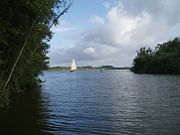
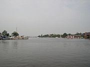
The Broads is a network of mostly navigable rivers and lakes (known locally as broads) in the English counties of Norfolk and Suffolk. The Broads, and some surrounding land was constituted as a special area with a level of protection similar to a UK National Park by The Norfolk and Suffolk Broads Act of 1988. The Broads Authority, a Special Statutory Authority responsible for managing the area, became operational in 1989.
The total area is 303 km² (188 sq. miles), most of which is in Norfolk, with over 200 km (125 miles) of navigable waterways. There are seven rivers and sixty three broads, mostly less than twelve feet deep. Thirteen broads are generally open to navigation, with a further three having navigable channels. Some broads have navigation restrictions imposed on them in autumn and winter.
Although the terms Norfolk Broads and Suffolk Broads are used to identify those areas within the two counties respectively, the whole area is sometimes referred to as the "Norfolk Broads". The Broads has the same status as the national parks in England and Wales but as well as the Broads Authority having powers and duties almost identical to the national parks it is also the third largest inland navigation authority. Because of its navigation role the Broads Authority was established under its own legislation on 1 April 1989. More recently the Authority wanted to change the name of the area to The Broads National Park in recognition of the fact that the status of the area is equivalent to the rest of the national park family but was unable to get agreement from all the different parties. The Private Bill the Authority is promoting through Parliament is largely about improving public safety on the water and the Authority did not want to delay or jeopardise these provisions for the name issue, so the provision was dropped before the Bill was deposited in Parliament.
Management
The Broads are managed by the Broads Authority. Special legislation gives the navigation of the waterways equal status with the conservation and public enjoyment of the area.
Specific parts of 'the Broads' have been awarded a variety of conservation designations, for instance:
- Special Protection Area (SPA) status for an area named 'Broadland' composed of 28 SSSIs Site of Special Scientific Interest
- Environmentally Sensitive Area (ESA) status for parts of the Halvergate Marshes
- National Nature Reserve (NNR) status for:
- Bure Marshes NNR
- Benacre NNR
- Ant Broads & Marshes NNR
- Hickling Broad NNR
- Ludham - Potter Heigham NNR
- Redgrave and Lopham Fen NNR
- Martham Broad NNR
- Calthorpe Broad NNR
- Mid-Yare NNR
A specific project being considered under the UK Biodiversity Action Plan is re-introduction of the Large Copper butterfly, whose habitat has been reduced by reduction of fens.
The Broads give their name to the Broadland district council area, although some of the geographical areas covered by the Broads are covered by a neighboring district council.
History
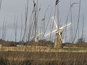
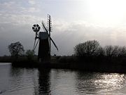
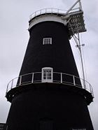
For many years the broads were regarded as natural features of the landscape. It was only in the 1960s that Dr Joyce Lambert proved that they were artificial features, the effect of flooding on early peat excavations. The Romans first exploited the rich peat beds of the area for fuel, and in the Middle Ages the local monasteries began to excavate the peat lands as a turbary business, selling fuel to Norwich and Great Yarmouth. The Cathedral took 320,000 tonnes of peat a year. Then the sea levels began to rise, and the pits began to flood. Despite the construction of windpumps and dykes, the flooding continued and resulted in the typical Broads landscape of today, with its reed beds, grazing marshes and wet woodland.
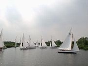
The Broads have been a favourite boating holiday destination since the early 20th century. The waterways are lock-free, although there are three bridges under which only small cruisers can pass. The area attracts all kinds of visitors, including ramblers, artists, anglers, and bird-watchers as well as people "messing about in boats". There are a number of companies hiring boats for leisure use, including both yachts and motor launches. The Norfolk Wherry, the traditional cargo craft of the area, can still be seen on the Broads as some specimens have been preserved and restored.
Ted Ellis, a local naturalist, referred to the Broads as "the breathing space for the cure of souls"
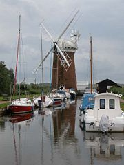
A great variety of boats can be found on the Broads, from Edwardian trading wherries to state-of-the-art electric or solar-powered boats.
Geography
The Broads largely follows the line of the rivers and natural navigations of the area. There are seven navigable rivers, the River Yare and its (direct and indirect) tributaries the Rivers Bure, Thurne, Ant, Waveney, Chet and Wensum. There are no locks on any of the rivers (except for Mutford lock in Oulton Broad that links to the saltwater Lake Lothing in Lowestoft), all the waterways are subject to tidal influence. The tidal range decreases with distance from the sea, with highly tidal areas such as Breydon Water contrasted with effectively non-tidal reaches such as the River Ant upstream of Barton Broad.
The broads themselves range in size from small pools to the large expanses of Hickling Broad, Barton Broad and Breydon Water. The broads are unevenly distributed, with far more broads in the northern half of Broadland (the Rivers Bure, Thurne and Ant) than in the central and southern portions (the Rivers Yare, Waveney, Chet and Wensum). Individual broads may lie directly on the river, or are more often situated to one side and connected to the river by an artificial channel or dyke.
Besides the natural watercourses of the rivers, and the ancient but artificial broads, there is one more recent navigation canal, the lock-less New Cut which connects the Rivers Yare and Waveney whilst permitting boats to by-pass Breydon Water.
There is also a second navigable link to the sea, via the River Waveney and its link to Oulton Broad. Oulton Broad is part of the Broads tidal system, but is immediately adjacent to Lake Lothing which is itself directly connected to the sea via the harbour at Lowestoft. Oulton Broad and Lake Lothing are connected by Mutford Lock, the only lock on the broads and necessary because of the different tidal ranges and cycles in the two lakes.
In the lists below, names of broads are emboldened to help distinguish them from towns and villages.
River Bure
The River Bure is a tributary of the River Yare which rises near Aylsham in Norfolk and joins the Yare just downstream of Breydon Water. On its way it flows through or passes:
- Coltishall
- Belaugh
- Belaugh Broad
- Bridge Broad
- Wroxham
- Hoveton
- Wroxham Broad
- Hoveton Great Broad
- Salhouse Broad
- Bure Marshes NNR ( National Nature Reserve)
- Salhouse
- Woodbastwick
- Decoy Broad
- Round End
- Hoveton Little Broad (sometimes called 'Blackhorse Broad')
- Burnt Fen Broad
- Horning
- Cockshoot Broad
- Ranworth Broad
- Malthouse Broad
- Ranworth
- South Walsham
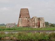
- St. Benet's Abbey
- Upton
- Upton Broad
- Upton Broads and Marshes Site of Special Scientific Interest
- Upton Fen
- Acle
- Oby
- Stokesby
- Mautby Decoy
- Great Yarmouth
River Thurne
The River Thurne is a tributary of the River Bure. It rises near Martham Broad and flows for about six miles to Thurne Mouth where it joins the Bure. It is wide open and wind-swept, and on its way it flows through or passes:
- Upper Thurne Broads and Marshes Site of Special Scientific Interest
- Hickling Broad
- Hickling
- Horsey
- Horsey Mere
- Martham Broad (NNR) ( National Nature Reserve)
- Martham
- West Somerton
- Thurne
- Potter Heigham
- Ludham
- Ludham - Potter Heigham NNR ( National Nature Reserve)
- Womack Water
River Ant
The River Ant is a tributary of the River Bure. It rises at Dilham and joins the Bure at St. Benet's Abbey. It is winding and narrow, and on its way it flows through or passes:
- Honing
- North Walsham & Dilham Canal
- Dilham
- Dilham Broad
- Wayford Bridge
- Barton Broad
- Stalham
- Sutton
- Sutton Broad
- Ant Broads & Marshes NNR ( National Nature Reserve)
- Turkey Broad
- Alderfen Broad
- Catfield Broad
- Crome's Broad
- Neatishead
- Barton Turf
- Irstead
- How Hill
- Ludham Bridge
- Broad Fen
- Calthorpe Broad (NNR) ( National Nature Reserve)
- Ingham, Norfolk
River Yare
The River Yare rises south of Dereham and flows through the southern fringes of the city of Norwich, passes through Breydon Water and flows into the sea between Great Yarmouth and Gorleston. On its way it passes through:
- RSPB Breydon Water
- Halvergate Marshes, also RSPB reserve
- Halvergate
- Berney Arms
- RSPB Berney Marshes
- Reedham
- Cantley
- Carleton Broad
- Rockland Broad
- Wheatfen Broad
- Strumpshaw Fen
- RSPB Strumpshaw Fen ( Royal Society for the Protection of Birds reserve)
- Mid-Yare NNR ( National Nature Reserve)
- Surlingham
- Surlingham Broad
- Surlingham Church Marsh RSPB reserve.
- Brundall Broad
- Haddiscoe
- Haddiscoe Cut also known as New Cut
- Brundall
- Langley
- Postwick
- Thorpe St. Andrew
- Barnby Broad
River Chet
The River Chet is a tributary of the River Yare. It flows through, or passes by:
- Loddon
- Chedgrave
- Hardley Flood
River Waveney
The River Waveney is a tributary of the River Yare, joining that river just upstream of Breydon Water. It flows through, or passes by:
- Burgh Castle
- Beccles
- Diss, Norfolk
- St. Olaves
- Herringfleet
- Somerleyton
- Fritton
- Fritton Decoy
- Gillingham
- Geldeston
- Burgh St. Peter
- Bungay
- Ditchingham
- Lowestoft
- Oulton Broad
- Kessingland
- Benacre Broad NNR ( National Nature Reserve)
- Covehithe Broad NNR
- Easton Broad NNR
River Wensum
The River Wensum is a tributary of the River Yare. It rises in the Breckland area of south-west Norfolk and flows through the centre of the city of Norwich before joining the Yare just to the east of that city. The navigable section of the river is entirely urban and runs from the centre of Norwich, past Norwich Cathedral to the confluence with the River Yare.
Trinity Broads
The Trinity Broads are an exception to the general rule, in that whilst they are connected to each other they have no navigable connection to the rest of the broads. The broads are:
- Rollesby Broad
- Ormesby Broad
- Filby Broad
- Lily Broad
- Ormesby Little Broad
Ecology
The Broads are Britain's largest protected wetland and are home to a wealth of wildlife, especially birdlife. Amongst the waterfowl: Mallard, Coot, Moorhen, Great Crested Grebe, Greylag Goose, Canada Goose, Egyptian Goose. Larger birds include Grey Heron, Cormorant, Kestrel, Sparrowhawk and Bittern.
The scarce Cetti's Warbler breeds in the Broads, and Britain's only breeding Common Cranes are found in the area.
Among the rare insects are the Norfolk hawker, a dragonfly and the Swallowtail butterfly. Some of the broads are surrounded by fens, i.e. reed and sedge beds. Norfolk reed from the broads has been a traditional material for thatching houses.
