Baghdad
2008/9 Schools Wikipedia Selection. Related subjects: Geography of the Middle East
| Baghdad بغداد |
|
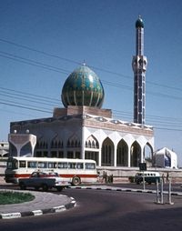
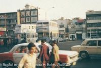
| A mosque in Baghdad, circa 1973. | |
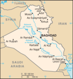
| The location of Baghdad within Iraq. | |
| Coordinates: | |
|---|---|
| Country | Iraq |
| Province | Baghdad Governorate |
| Government | |
| - Mayor | Sabir al-Isawi |
| Area | |
| - City | 204.2 km² (78.8 sq mi) |
| Elevation | 34 m (112 ft) |
| Population (2006) | |
| - City | 6.0 million |
| - Density | 30,000/km² (77,699.6/sq mi) |
| - Metro | 8.0 million |
| Approximate figures | |
| Time zone | GMT +3 ( UTC) |
| - Summer ( DST) | +4 ( UTC) |
Baghdad (Arabic: بغداد Baġdād) is the capital of Iraq and of Baghdad Governorate. With a metropolitan area estimated at a population of 7,000,000, it is the largest city in Iraq. It is the second-largest city in the Arab World (after Cairo) and the second-largest city in southwest Asia (after Tehran).
Located on the Tigris River, the city dates back to at least the 8th century, and probably to pre-Islamic times. Once the centre of Dar al-salam, the Muslim world, Baghdad has been a centre of violent conflict since 2003 because of the ongoing Iraq War.
Name
Although there is no dispute over its Iranian origin , there have been several rival proposals as to its specific etymology. The most reliable and most widely accepted among these is that the name is a Middle Persian compound of Bhaga "god" + dād "given", translating to "god-given" or "God's gift", whence Modern Persian Baɣdād, Arabic Baġdād. Another leading proposal is that the name comes from Middle Persian Bāgh-dād "The Given Garden".
History
Foundation
The city of Baghdad is often said to have been founded on the west bank of the Tigris on 30 July 762 by the Abbasid dynasty, led by caliph al-Mansur, replacing Harran as the seat of the caliphal government; however, a city of Baghdad is mentioned in pre-Islamic texts, including the Talmud, and the Abbasid city was likely built on the site of this earlier settlement.
Baghdad eclipsed Ctesiphon, the capital of the Persian Empire, which was located some 30 km (20 miles) to the southeast, which had been under Muslim control since 637, and which became quickly deserted after the foundation of Baghdad. The site of Babylon, which had been deserted since the 2nd century BC, lies some 90 km (55 miles) to the south.
The city was designed as a circle about 2 km in diameter, leading it to be known as the "Round City". The original design shows a ring of residential and commercial structures along the inside of the city walls, but the final construction added another ring, inside the first. In the center of the city lay the mosque, as well as headquarters for guards. The purpose or use of the remaining space in the centre is unknown. The circular design of the city was a direct reflection of the traditional Persian Sasanian urban design. The ancient Sasanian city of Gur/ Firouzabad is nearly identical in its general circular design, radiating avenues, and the government buildings and temples at the centre of the city.
The roundness points to the fact that it was based on Persian precedents such as Firouzabad in Persia. The two designers who were hired by al-Mansur to plan the city's design were Naubakht, a former Persian Zoroastrian who also determined that the date of the foundation of the city would be astrologically auspicious, and Mashallah, a Jew from Khorasan, Iran.
A centre of learning (8th to 9th c.)
Within a generation of its founding, Baghdad became a hub of learning and commerce. The House of Wisdom was an establishment dedicated to the translation of Greek, Middle Persian and Syriac works. The Barmakids were influential in bringing scholars from the nearby Academy of Gundishapur, facilitating the introduction of Greek and Indian science into the Arabic world. Baghdad was likely the largest city in the world from shortly after its foundation until the 930s, when it was tied by Córdoba. Several estimates suggest that the city contained over a million inhabitants at its peak. A portion of the population of Baghdad originated in Iran, especially from Khorasan. Many of Scheherazade's tales in One Thousand and One Nights are set in Baghdad during this period.
Stagnation and invasions (10th to 16th c.)
By the 10th century, the city's population was between 300,000 and 500,000. Baghdad's early meteoric growth slowed due to troubles within the Caliphate, including relocations of the capital to Samarra (during 808–819 and 836–892), the loss of the western and easternmost provinces, and periods of political domination by the Iranian Buwayhids (945–1055) and Seljuk Turks (1055–1135). Nevertheless, the city remained one of the cultural and commercial hubs of the Islamic world until February 10, 1258, when it was sacked by the Mongols under Hulagu Khan during the sack of Baghdad. The Mongols massacred most of the city's inhabitants, including the Abbasid Caliph Al-Musta'sim, and destroyed large sections of the city. The canals and dykes forming the city's irrigation system were also destroyed. The sack of Baghdad put an end to the Abbasid Caliphate, a blow from which the Islamic civilization never fully recovered.
At this point Baghdad was ruled by the Il-Khanids, the Mongol emperors of Iran. In 1401, Baghdad was again sacked, by Timur ("Tamerlane"). It became a provincial capital controlled by the Jalayirid (1400–1411), Qara Quyunlu (1411–1469), Aq Quyunlu (1469–1508), and Safavid (1508–1534) dynasties.
Ottoman Baghdad (16th to 19th c.)
In 1534, Baghdad was conquered by the Ottoman Turks. Under the Ottomans, Baghdad fell into a period of decline, partially as a result of the enmity between its rulers and Persia. For a time, Baghdad had been the largest city in the Middle East. The city saw relative revival in the latter part of the 18th century under the Mamluk rule. The Nuttall Encyclopedia reports the 1907 population of Baghdad as 185,000.
20th century
Baghdad remained under Ottoman rule until the establishment of the kingdom of Iraq under British control in 1921. British control was established by a systematic suppression of Iraqi Arab and Kurdish national aspirations. Iraq was given formal independence in 1932, and increased autonomy in 1946. In 1958 the Iraqi Army deposed the grandson of the British-installed monarch, Faisal II. The city's population grew from an estimated 145,000 in 1900 to 580,000 in 1950 of which 140,000 were Jewish.
During the 1970s Baghdad experienced a period of prosperity and growth because of a sharp increase in the price of petroleum, Iraq's main export. New infrastructure including modern sewage, water, and highway facilities were built during this period. However, the Iran-Iraq War of the 1980s was a difficult time for the city, as money flowed into the army and thousands of residents were killed. Iran launched a number of missile attacks against Baghdad, although they caused relatively little damage and few casualties. In 1991 the Persian Gulf War caused damage to Baghdad's transportation, power, and sanitary infrastructure.
2003 Invasion of Iraq
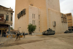
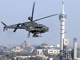
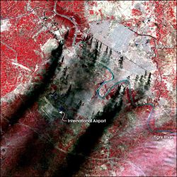
Baghdad was bombed very heavily in March and April 2003 in the 2003 invasion of Iraq, and fell under US control by April 7- April 9. Additional damage was caused by the severe looting during the days following the end of the war. With the deposition of Saddam Hussein's regime, the city was occupied by U.S. troops. The Coalition Provisional Authority established a three-square-mile (8 km²) " Green Zone" within the heart of the city from which it governed Iraq during the period before the new Iraqi government was established. The Coalition Provisional Authority ceded power to the interim government at the end of June 2004 and dissolved itself.
On September 23, 2003, a Gallup poll indicated that about two-thirds of Baghdad residents said that the removal of the Iraqi leader was worth the hardships they encountered, and that they expected a better life in five years' time. As time passed, however, support for the occupation declined dramatically. In April 2004, USA Today reported that a follow-up Gallup poll in Baghdad indicated that "only 13 percent of the people now say the invasion of Iraq was morally justifiable. In the 2003 poll, more than twice that number saw it as the right thing to do."
Most residents of Baghdad became impatient with the United States because essential services such as electricity were still unreliable more than a year after the invasion. In the hot summer of 2004, electricity was only available intermittently in most areas of the city. An additional pressing concern was the lack of security. The curfew imposed immediately after the invasion had been lifted in the winter of 2003, but the city that had once had a vibrant night life was still considered too dangerous after dark for many citizens. Those dangers included kidnapping and the risk of being caught in fighting between security forces and insurgents.
On 10th April 2007, the United States military began construction of a three mile (5 km) long 3.5 metre tall wall around the Sunni district of Baghdad (Guardian). On 23rd April , the Iraqi Prime Minister, Nouri Maliki, called for construction to be halted on the wall (Guardian) (BBC).
The city of Baghdad is largely Shia city (about 60% of the city's population), a smaller Sunni population, and a very small Christian, Sabeaa and Yazeedi minorities .
Geography and climate
The city is located on a vast plain bisected by the Tigris River. The Tigris splits Baghdad in half, with the Eastern half being called ' Risafa' and the Western half known as ' Karkh'. The land on which the city is built is almost entirely flat and low-lying, being of alluvial origin due to the periodic large floods which have occurred on the river.
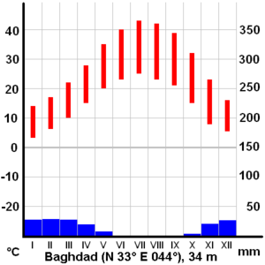
Baghdad has a hot arid climate ( Koppen climate classification BWh) and is, in terms of maximum temperatures, one of the hottest cities in the world. In the summer from June to August, the average maximum temperature is as high as 44 °C (111 °F) accompanied by blazing sunshine: rainfall is almost completely unknown at this time of year. Temperatures exceeding 50 °C (122 °F) in the shade are by no means unheard of, and even at night temperatures in summer are seldom below 24 °C (75 °F) Though the humidity is very low (usually under 10%) due to Baghdad's distance from the marshy Persian Gulf, dust storms from the deserts to the west are a normal occurrence during the summer.
In the winter, from December to February, by contrast, Baghdad has maximum temperatures averaging 15 to 16 °C (59 to 61 °F). Minima can indeed be very cold: the average January minimum is around 4 °C (39 °F) but temperatures below 0 °C (32 °F) are not uncommon during this season.
Annual rainfall, almost entirely confined to the period from November to March, averages around 140 millimetres (5.5 in), but has been as high as 575 millimetres (23 in) and as low as 23 millimetres (~1 in). On January 11th of 2008, light snow fell across Baghdad for the first time in memory, causing temperatures to fall below zero degrees Centigrade (32 degrees Fahrenheit).
Reconstruction efforts
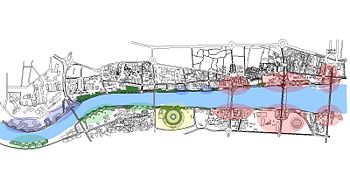
Most Reconstruction of Iraq efforts have been devoted to the restoration and repair of badly damaged infrastructure of the city. More visible efforts at reconstruction through private development, such as architect and urban designer Hisham N. Ashkouri's Baghdad Renaissance Plan and Sindbad Hotel Complex and Conference Centre garnered early interest, but remain undeveloped due to the instability of the region.
Government
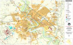
The City of Baghdad has 89 official neighborhoods within 9 districts. These official subdivisions of the city served as administrative centers for the delivery of municipal services but until 2003 had no political function. Beginning in April 2003, the U.S. controlled Coalition Provisional Authority (CPA) began the process of creating new functions for these. The process initially focused on the election of neighborhood councils in the official neighborhoods, elected by neighborhood caucuses. CPA convened a series of meetings in each neighborhood to explain local government, to describe the caucus election process and to encourage participants to spread the word and bring friends, relatives and neighbors to subsequent meetings. Each neighborhood process ultimately ended with a final meeting where candidates for the new neighborhood councils identified themselves and asked their neighbors to vote for them. Once all 88 (later increased to 89) neighborhood councils were in place, each neighborhood council elected representatives from among their members to serve on one of the city's nine district councils. The number of neighborhood representatives on a district council is based upon the neighborhood’s population. The next step was to have each of the nine district councils elect representatives from their membership to serve on the 37 member Baghdad City Council. This three tier system of local government connected the people of Baghdad to the central government through their representatives from the neighbourhood, through the district, and up to the city council.
The same process was used to provide representative councils for the other communities in Baghdad Province outside of the City itself. There, local councils were elected from 20 neighborhoods (Nahia) and these councils elected representatives from their members to serve on six district councils (Qada). As within the City, the district councils then elected representatives from among their members to serve on the 35 member Baghdad Regional Council.
The final step in the establishment of the system of local government for Baghdad Province was the election of the Baghdad Provincial Council. As before, the representatives to the Provincial Council were elected by their peers from the lower councils in numbers proportional to the population of the districts they represent. The 41 member Provincial Council took office in February, 2004 and served until National elections held in January 2005, when a new Provincial Council was elected.
This system of 127 separate councils may seem overly cumbersome but Baghdad Province is home to approximately seven million people. At the lowest level, the neighbourhood councils, each council represents an average of 74,000 people.
The nine District Advisory Councils (DAC) are as follows :
- Adhamiyah
- Karkh
- Karadah
- Kadhimyah
- Mansour
- Sadr City ( Thawra)
- Rasheed
- Rusafa
- Tisaa Nissan (9th of April)
Culture
Baghdad has always played an important role in Arab cultural life and has been the home of noted writers, musicians and visual artists.
The dialect of Arabic spoken in Baghdad today differs from that of other large urban centers in Iraq, having features more characteristic of nomadic Arabic dialects (Verseegh, The Arabic Language). It is possible that this was caused by the repopulating of the city with rural residents after the multiple sacks of the late Middle Ages.
Institutions
Some of the important cultural institutions in the city include:
- Iraqi National Orchestra – Rehearsals and performances were briefly interrupted during the second Gulf War, but have since returned to normal.
- National Theatre of Iraq – The theatre was looted during the 2003 Invasion of Iraq, but efforts are underway to restore the theatre.
The live theatre scene received a boost during the 1990s when UN sanctions limited the import of foreign films. As many as 30 movie theatres were reported to have been converted to live stages, producing a wide range of comedies and dramatic productions.
Institutions offering cultural education in Baghdad include the Academy of Music, Institute of Fine Arts and the Music and Ballet School. Baghdad is also home to a number of museums which housed artifacts and relics of ancient civilizations; many of these were stolen, and the museums looted, during the widespread chaos immediately after U.S. forces entered the city.
During the 2003 occupation of Iraq, AFN Iraq ("Freedom Radio") broadcast news and entertainment within Baghdad, among other locations. There is also a private radio station called "Dijlah" (named after the Arabic word for the Tigris River) that was created in 2004 as Iraq's first independent talk radio station. Radio Dijlah offices, in the Jamia neighbourhood of Baghdad, have been attacked on several occasions.
Sights and monuments
Points of interest include the National Museum of Iraq whose priceless collection of artifacts was looted during the 2003 invasion the iconic Hands of Victory arches which have been a contentious issue as to their continued presence multiple Iraqi parties are in discussions as to whether they should remain as historical monuments or be dismantled. Thousands of ancient manuscripts in the National Library were destroyed when the building burnt down during the 2003 invasion of Iraq The Al Kadhimain Shrines in the northwest of Baghdad (in Kadhimiya) is one of the most important Shi'ite religious buildings in Iraq. It was finished in 1515 and the 7th ( Musa ibn Jafar al-Kathim) and the 9th Imams ( Mohammad al-Jawad) were buried here. One of the oldest buildings is the 12th century or 13th century Abbasid Palace. The palace is part of the central historical area of the city and close to other historically important buildings such as the Saray Building and Al-Mustansiriyah School (From the Abbasid Period). There are other landmarks in Baghdad, each of them marks a certain era and has become associated with memorable events or even just changes that marked the city scape. Here are some of them:
- Baghdad Tower (used to be known as Saddam Tower): before its partial destruction due to the USA bombing of the Ma'amoon Telecommunication Centre next to it, the tower used to be the highest point in the city and from where all Baghdad can be seen. The construction of the tower marks a period of the post-Gulf-war of 1991 reconstruction efforts.
- The Two Level Bridge in Jadriyah (Jisr Abul Tabqain). Even though planing for this bridge began before Saddam's take over, the bridge was never built. As part of recent reconstruction efforts, the long planned bridge was built. It connects Al-Doura area with the rest of the Baghdad and complements the 14th of July Bridge.
- Sahat Al Tahrir (Liberation Square) downtown Baghdad.
- Al-Zawra'a Park in Al-Mansour Area and almost in a central location of Baghdad.
- Kahramana and the 40 Thieves Square.
- Al Jundi Al Majhool Monument (The unknown soldier).
- Al Shaheed Monument. Monument to the Iraqi soldiers killed in the Iran-Iraq war, located on the east bank of the Tigris.
- A wide road built under Saddam as a parade route, and across it is the Hands of Victory, which is a pair of enormous crossed swords cast from weapons of soldiers who died in the Iran-Iraq War under Saddam's command.
Baghdad Zoo
Baghdad Zoo was the biggest zoo in the Middle East; however, by 8 days after the 2003 invasion, out of 650 to 700 animals in the Baghdad Zoo only 35 survived owing to bombing of the zoo, looting of the animals for food, and starvation of the caged animals without food and water. The animals that survived were some of the larger animals, including bears, lions and tigers. In the chaos of the war, the South African, Lawrence Anthony with some of the zoo keepers looked after the animals, and fed the carnivores by buying donkeys. Eventually, Bremer supported the zoo and American engineers helped to reopen the zoo.
Sport
Baghdad is home to some of the most successful football teams in Iraq, the biggest being Al Quwa Al Jawiya (Airforce club), Al Zawra, Al Shurta (Police) and Al Talaba (Students). The largest stadium in Baghdad is Al Shaab Stadium which was opened in 1966. Another. Much larger stadium, are still in the opening stages of construction.
The city has also had a strong tradition of horse racing ever since World War I, known to Baghdadis simply as 'Races'. There are reports of pressures by the Islamists to stop this tradition due to the associated gambling.
Baghdad's major neighborhoods
- Adhamiyah
- Al-Kadhimya
- Al- Ghazaliya
- Al-A'amiriya
- Dora
- Karrada
- Al-Jadriya Area
- Al-Mansour
- Zayouna
- Sadr City
- Al-Saydiya
- Hurriya City
- Baghdad Al-Jadida( New Baghdad)
- Al Baladeyat - Tisaa Nisan (9th of April)
- Al-Sa'adoon area
- Al-Shu'ala
- Bab Al-Moatham
- Bab Al-Sharqi
- Al-Baya'
- Al-Za'franiya
- Hayy Ur
- Sha'ab
- Hayy Al-Jami'a
- Al-Adel
- Al:Khadhraa
- Hayy Al-Jihad
- Hayy Al-A'amel
- Hayy Al-Mansor
- Hayy Aoor
- Al-Horaya
- Hayy Al-Shurtta
- Yarmouk
- Al-Saydiya
- Jesr Diyala
- Abu Disher
- Raghiba Khatoun
- Arab Jijur
- Al-Awashosh
- Al-Fathel
- hoor Rajab
- Al-Ubedy
- Hifah Street
- Al-Wazireya
Baghdad's major streets
Source: stripes.com
- Haifa Street
- Al-Rashid Street -- the city's main street, stretching from North Gate to South Gate.
- Hilla Road -- Runs from the South into Baghdad via Yarmouk (Baghdad)
- Caliphs Street -- site of historical mosques and churches.
- Sadoun Street -- stretching from Liberation Square to Masbah
- Mohammed Al-Qassim highway near Adhamiyah
- Abu Nuwas Street -- runs along the Tigris from the from Jumhouriya Bridge to the 14 July Suspended Bridge
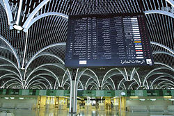
- Damascus Street -- goes from Damascus Square to the International Airport Road
- Mutanabbi Street -- A street with numerous bookshops, named after the 10th century Iraqi poet Al-Mutanaby
- Rabia Street
- Arbataash Tamuz (14th July) Street ( Mosul Road)
- Muthana al-Shaibani Street
- Bor Saeed (Port Said) Street
- Thawra Street
- Al Qanat Street -- runs through Baghdad north-south
- Al Khat al Sare'a - Mohammed al Qasim (High Speed lane) - runs through bagdhad, north -south
- Al Sinaa Street (Industry St.) runs by the University of Technology - centre of computers trade in Baghdad.
- Al Nidhal Street
- Al Rasheed Street -- Downtown Baghdad
- Al Jamhuriah Street -- Downtown Baghdad
- Falastin (Palestine) Street
- Tariq el Muaskar -- (Al Rasheed Camp Road)
- Matar Baghdad Al-Dawli (Airport Road)
