Arctic
2008/9 Schools Wikipedia Selection. Related subjects: Geography
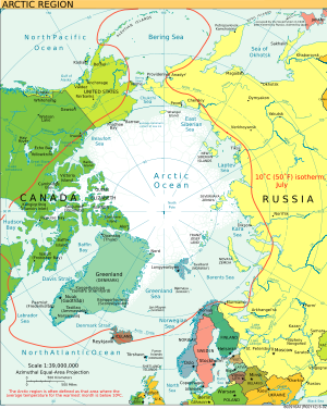
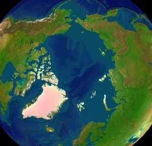
The Arctic is the region around the Earth's North Pole, opposite the Antarctic region around the South Pole. The Arctic includes the Arctic Ocean (which overlies the North Pole) and parts of Canada, Greenland (a territory of Denmark), Russia, the United States ( Alaska), Iceland, Norway, Sweden and Finland. The word Arctic comes from the Greek word arktos (άρκτος) , which means bear. The name refers to the constellation Ursa Major, the "Great Bear", which dominates the northern region of the celestial sphere.
There are numerous definitions of the Arctic region. The boundary is generally considered to be north of the Arctic Circle (66° 33’N), which is the approximate limit of the midnight sun and the polar night. Other definitions are based on climate and ecology, such as the 10°C (50°F) July isotherm, which roughly corresponds to the tree line in most of the Arctic. Socially and politically, the Arctic region includes the northern territories of the eight Arctic states, including Lapland, although by natural science definitions much of this territory is considered subarctic.
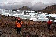
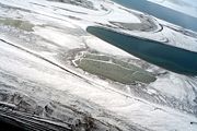
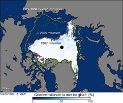
The Arctic region consists of a vast ice-covered ocean (which is sometimes considered to be a northern arm of the Atlantic Ocean) surrounded by treeless, frozen ground. In recent years the extent of the sea ice has declined, and there is some evidence suggesting Arctic water may be ice-free in summer. According to the Norwegian International Polar Year Secretariat and polar scientists, this ice cap may disappear over the summer of 2008 Life in the Arctic includes organisms living in the ice, zooplankton and phytoplankton, fish and marine mammals, birds, land animals, plants, and human societies.
The Arctic region is a unique area among Earth's ecosystems. The cultures in the region and the Arctic indigenous peoples have adapted to its cold and extreme conditions.
Nature
Climate
The Arctic's climate is characterized by cold winters and cool summers. Precipitation mostly comes in the form of snow. The Arctic's annual precipitation is low, with most of the area receiving less than 50 cm (20 inches). High winds often stir up snow, creating the illusion of continuous snowfall. Average winter temperatures can be as low as -40°C (-40°F), and the coldest recorded temperature is approximately -68°C (-90°F). Coastal Arctic climates are moderated by oceanic influences, having generally warmer temperatures and heavier snowfalls than the colder and drier interior areas.
Plants
Arctic vegetation is composed of plants such as dwarf shrubs, graminoids, herbs, lichens and mosses, which all grow relatively close to the ground, forming tundra. As one moves northward, the amount of warmth available for plant growth decreases considerably. In the northernmost areas, plants are at their metabolic limits, and small differences in the total amount of summer warmth make large differences in the amount of energy available for maintenance, growth and reproduction. Colder summer temperatures cause the size, abundance, productivity and variety of plants to decrease. Trees cannot grow in the Arctic, but in its warmest parts, shrubs are common and can reach 2 m (6 ft) in height; sedges, mosses and lichens can form thick layers. In the coldest parts of the Arctic, much of the ground is bare; nonvascular plants such as lichens and mosses predominate, along with a few scattered grasses and forbs (like the Arctic poppy).
Animals
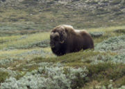
Herbivores on the Tundra include the Arctic hare, lemming, muskox, and caribou. They are preyed on by the Arctic fox and wolf. The polar bear is also a predator, though it prefers to hunt for marine life from the ice. There are also many birds and marine species endemic to the colder regions. Other land animals include wolverines, ermines, lemmings, and arctic ground squirrels. Marine mammals include seals, walrus, and several species of cetacean -- baleen whales and also narwhals and belugas.
Paleo-history
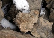
During the Cretaceous, the Arctic still had seasonal snows, though only a light dusting and not enough to permanently hinder plant growth. Animals such as Chasmosaurus, Hypacrosaurus, Troodon, and Edmontosaurus may have all migrated north to take advantage of the summer growing season, and migrated south to warmer climes when the winter came. A similar situation may also have been found amongst dinosaurs that lived in Antarctic regions, such as Muttaburrasaurus of Australia.
Indigenous population
The Inuit are the descendants of what anthropologists call the Thule culture, a nomadic people who emerged from western Alaska around 1000 CE and spread eastwards across the Arctic, displacing the related Dorset culture (in Inuktitut, the Tuniit). Inuit legends speak of the Tuniit as "giants", people who were taller and stronger than the Inuit, but who were easily scared off and retreated from the advancing Inuit. Researchers believe that the Dorset culture lacked dogs, boats and other technologies that gave the expanding Inuit society a large advantage over them. By 1300, the Inuit had settled west Greenland, and finally moved into east Greenland over the following century.
The Tuniit survived in Aivilik, Southampton and Coats Islands, until the beginning of the 20th century. They were known as Sadlermiut (Sallirmiut in the modern spelling). Their population had been ravaged by diseases brought by contact with Europeans, and the last of them fell in a flu epidemic caught from a passing whaler in 1902. The area has since been resettled by Inuit. Genetic research suggests that there was little or no intermarriage between the Tuniit and the Inuit over the thousand years of contact in the Canadian Arctic.
International cooperation and politics
The Arctic region is a focus of international political interest. International Arctic cooperation got underway on a broad scale well over ten years ago. The International Arctic Science Committee (IASC), hundreds of scientists and specialists of the Arctic Council, the Barents Council and its regional cooperation have compiled high quality information on the Arctic.
Territorial claims
No country owns the North Pole or the region of the Arctic Ocean surrounding it. The surrounding Arctic states, the United States, Canada, Russia, Norway and Denmark (via Greenland), are limited to a 370 kilometre (200 nautical mile) economic zone around their coasts.
Upon ratification of the United Nations Convention on the Law of the Sea, a country has ten years to make claims to extend its 200 mile zone. Due to this, Norway (ratified the convention in 1996), Russia (ratified in 1997), Canada (ratified in 2003) and Denmark (ratified in 2004) launched projects to establish claims that certain Arctic sectors should belong to their territories.
On August 2, 2007, two Russian bathyscaphes, MIR-1 and MIR-2, for the first time in history descended to the Arctic seabed beneath the North Pole and placed there a Russian flag made of rust-proof titanium alloy. The mission was a scientific expedition, but the flag-placing raised concerns of a race for control of the Arctic's vast petroleum resources(See 2007 Russian North Pole expedition)
Foreign Ministers and other officials representing Canada, Denmark, Norway, Russia, and the United States met in Ilulissat, Greenland on May 28, 2008 at the Arctic Ocean Conference and announced the Ilulissat Declaration.
A strategic military region
Some countries claim the Arctic has never been under the political control of any nation, although some nations' militaries have attached a strategic importance to the region. Canada has an outpost in the region ( Alert) and has long laid claim to much of the Arctic. Several recent excursions by the Canadian navy have taken place, with more planned to underline Canadian sovereignty in the region. On July 9th, 2007, Canada's prime minister Stephen Harper announced that Canada will build up to eight armed patrol ships with helicopter pads and a deep water port at a location yet to be disclosed to reassert Canada's sovereignty over Arctic territories.
In the 1950s and 1960s, the Arctic was often used by submarines to test new weapons, sonar equipment, and depth capability. During the Cold War, the Arctic region was extensively monitored by the United States military and NATO, since it was believed that the first warnings of a nuclear strike from the Soviet Union would have been indicated by ICBMs launched over the North Pole towards the United States. (See Distant Early Warning Line.) The United States placed such importance on the region that two military decorations, the Arctic Service Ribbon and Coast Guard Arctic Service Medal, were established for military duty performed within the Arctic Circle.
In 2006, Envisat and EOS Aqua revealed a polar route connecting Spitsbergen and Siberia. Increased Russian activity has also been detected, though this can be attributed to the Chelyuskin icebreaker wreck expeditionary force.
Scientific exploration
Since 1937 the whole Arctic region was extensively explored by the Soviet and Russian manned drifting ice stations. Scientific settlements that were established on the drift ice were carried thousands of kilometers by the ice flow.
Pollution
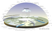
The Arctic is comparatively clean, although there are certain ecologically difficult localized pollution problems that present a serious threat to people’s health living around these pollution sources. Due to the prevailing worldwide sea and air currents, the Arctic area is the fallout region for long-range transport pollutants, and in some places the concentrations exceed the levels of densely populated urban areas. An example of this is the phenomenon of Arctic haze, which is commonly blamed on long-range pollutants. Another example is with the bioaccumulation of PCB's ( polychlorinated biphenyls) in Arctic wildlife and people.
Climate change
The Arctic is especially vulnerable to the effects of global warming as has become apparent in the melting sea ice in recent years. Climate models predict much greater warming in the Arctic than global average. This fact has garnered significant international attention to the region. In particular, there are concerns that Arctic shrinkage, a consequence of melting glaciers and other ice in Greenland, could soon contribute to a substantial rise in sea levels worldwide. A recent study by a research group at Naval Postgraduate School, Monterey, California working with members of NASA and the Institute of Oceanology at the Polish Academy of Sciences estimate that the Arctic sea could be ice-free in the summer as soon as 2013. The Arctic sea ice melted at an unprecedented rate, well ahead of models, in 2007. However, according to the Norwegian International Polar Year Secretariat, the Arctic polar ice cap would be completely gone by summer 2008 .
Apart from concerns regarding the detrimental effects of cooling in the Arctic, some potential opportunities have gained attention as well. The melting of the ice is making the so-called Northwest passage, the shipping routes through the northern-most latitudes, more navigable, raising the possibility that the Arctic region will become a prime trade route. In addition, it is believed that the Arctic seabed may contain substantial oil fields which may become accessible if the ice covering them melts. These factors have led to recent international debates as to which nations can claim sovereignty or ownership over the waters of the Arctic..
NOAA's Arctic Report Card presents peer-reviewed information on recent observations of environmental conditions in the Arctic relative to historical records. Collectively, atmosphere, sea ice, biology, ocean, Greenland ice sheet and land parameters indicate that the overall warming of the Arctic system continued in 2007. There are some elements that are stabilizing or returning to climatological norms. These mixed tendencies illustrate the sensitivity and complexity of the Arctic System.
Arctic waters
- Arctic Ocean
- Baffin Bay
- Beaufort Sea
- Barents Sea
- Bering Sea
- Bering Strait
- Chukchi Sea
- Davis Strait
- Denmark Strait
- East Siberian Sea
- Greenland Sea
- Hudson Bay
- Kara Sea
- Laptev Sea
- Nares Strait
- Norwegian Sea
Arctic lands
- Alaska (USA)
- Aleutian Islands (USA)
- Bear Island (Norway)
- Canadian Arctic Archipelago
- Diomede Islands (Russia/USA)
- Franz Josef Land (Russia)
- Newfoundland and Labrador (Canada)
- New Siberian Islands (Russia)
- Northwest Territories (Canada)
- Novaya Zemlya (Russia)
- Nunavik (northern Québec, Canada)
- Nunavut (Canada)
- Finnmark (Norway)
- Greenland (Denmark)
- Iceland
- Jan Mayen (Norway)
- Severnaya Zemlya (Russia)
- Siberia (Russia)
- Svalbard (Norway)
- Yukon (Canada)
- Wrangel Island (Russia)
