2004 Atlantic hurricane season
2008/9 Schools Wikipedia Selection. Related subjects: Natural Disasters
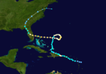
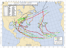 Season summary map |
|
| First storm formed: | July 31, 2004 |
|---|---|
| Last storm dissipated: | December 2, 2004 |
| Strongest storm: | Ivan - 910 mbar ( hPa) (26.88 inHg), 165 mph (270 km/h) |
| Total storms: | 15 |
| Hurricanes: | 9 |
| Major hurricanes ( Cat. 3+): | 6 |
| Total fatalities: | 3,132+ |
| Total damage: | $50 billion (2004 USD) $57 billion (2008 USD) |
| Atlantic hurricane seasons 2002, 2003, 2004, 2005, 2006 |
|
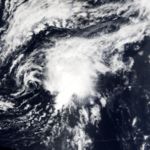
The 2004 Atlantic hurricane season officially began on June 1, 2004, and lasted until November 30, 2004. These dates conventionally delimit the period of each year when most tropical cyclones form in the Atlantic basin. However, the 2004 season exceeded these conventional limits slightly, as Tropical Storm Otto formed on the last day of the season and lasted two days into December. The season was well above average in activity, with fifteen named storms and one of the highest Accumulated Cyclone Energy totals ever observed.
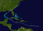
The season was notable as one of the deadliest and most costly Atlantic hurricane seasons on record, with at least 3,132 deaths and roughly $50 billion (2004 US dollars) in damage. The most notable storms for the season were the five named storms that made landfall in the U.S. state of Florida, three of them with at least 115 mph (185 km/h) sustained winds: Tropical Storm Bonnie, Charley, Frances, Ivan, and Jeanne. This is the only time in recorded history that five hurricanes have ever hit one state in a single season. Jeanne wreaked havoc in Haiti, killing approximately 3,000 people, while Ivan raged through Grenada, Jamaica, and the Cayman Islands; Frances and Jeanne both hit the Bahamas at full force, while Charley caused significant damage in Cuba. Furthermore, all five of these hurricanes, as well as one tropical storm, hit the U.S. state of Florida, with Frances and Jeanne hitting nearly the exact same location within three weeks of each other; floodwaters in the southeastern United States were brought to near-record levels.
Seasonal forecasts
| Source | Date | Tropical storms |
Hurricanes | Major hurricanes |
| CSU | Average (1950–2000) | 9.6 | 5.9 | 2.3 |
| NOAA | Average | 11 | 6 | 2 |
| NOAA | 17 May 2004 | 12–15 | 6–8 | 2–4 |
| CSU | 28 May 2004 | 14 | 8 | 3 |
| CSU | 6 August 2004 | 13 | 7 | 3 |
| Actual activity | 15 | 9 | 6 | |
Pre-season outlook
On May 17, prior to the start of the season, NOAA forecasters predicted a 50% probability of activity above the normal range, with 12–15 tropical storms, 6–8 of those becoming hurricanes, and 2–4 of those hurricanes reaching at least Category 3 strength on the Saffir-Simpson Hurricane Scale.
Noted hurricane expert Dr. William Gray's May 28 prediction was similar, with 14 named storms, 8 reaching hurricane strength, and 3 reaching Category 3 strength.
Mid-season outlook
On August 6, Dr. Gray announced he had revised his predictions slightly downwards, citing mild El Niño conditions, to 13 named storms, 7 hurricanes, and 3 reaching category 3. Several days later, NOAA released an updated prediction as well, with a 90% probability of above-to-near normal activity, but the same number of storms forecast.
A normal season, as defined by NOAA, has 6 to 14 tropical storms, 4 to 8 of which reach hurricane strength, and 1 to 3 of those reaching Category 3 strength.
The season ended up with 16 tropical depressions, 15 named storms, 9 hurricanes, and six major hurricanes, placing it above all forecasts.
Seasonal activity
This season had 16 tropical depressions, 15 named storms, 9 hurricanes, and 6 major hurricanes (Category 3 or higher on the Saffir-Simpson Hurricane Scale). The Accumulated Cyclone Energy figure of 225 ranks this as the fourth most active season since 1950 (behind the 2005 season, the 1950 season and the 1995 season).
August 2004 was unusually active, with eight named storms forming during the month. In an average year, only three or four storms would be named in August. The formation of eight named storms in August breaks the old record of seven for the month, set in the 1933 and 1995 seasons. It also ties with September in the 2002 and the 2007 seasons for the most Atlantic tropical storms to form in any month.
Deaths and damage
The 2004 season was very deadly, with over 3,000 deaths related to the flooding rains or winds caused by the storms. Nearly all of the deaths were reported in Haiti following the floods and mudslides caused by then-Tropical Storm Jeanne.
A tropical low in May brought torrential flooding to Haiti and the Dominican Republic, killing 2,000 people and causing great damage. Though it was not officially classified as a tropical storm, it did have a circulation with loosely organized convection, resembling a subtropical cyclone.
Records and notable events
The 2004 season had numerous unusual occurrences. The first named storm of the season formed on August 1, giving the season the fifth-latest start since the 1952 season. Tropical Storm Bonnie and Hurricane Charley became the first storms to sequentially hit the same U.S. state — Florida — within 24 hours of each other in recorded history. For the remainder of the season, Florida was hit by three more hurricanes: Frances, Ivan, and Jeanne. It was the first time four hurricanes have hit one state in one season since four hurricanes hit the Texas coast in the 1886 season, including the Indianola Hurricane of 1886 that destroyed the city of Indianola.
| Rank | Hurricane | Season | Min. pressure |
|---|---|---|---|
| 1 | Wilma | 2005 | 882 mbar ( hPa) |
| 2 | Gilbert | 1988 | 888 mbar (hPa) |
| 3 | "Labor Day" | 1935 | 892 mbar (hPa) |
| 4 | Rita | 2005 | 895 mbar (hPa) |
| 5 | Allen | 1980 | 899 mbar (hPa) |
| 6 | Katrina | 2005 | 902 mbar (hPa) |
| 7 | Camille | 1969 | 905 mbar (hPa) |
| Mitch | 1998 | 905 mbar (hPa) | |
| Dean | 2007 | 905 mbar (hPa) | |
| 10 | Ivan | 2004 | 910 mbar (hPa) |
| Source: U.S. Department of Commerce | |||
Other storms were individually unusual. Hurricane Alex was the strongest hurricane on record to intensify north of 38°N latitude. One storm, Tropical Storm Earl, died out, and its remains crossed over into the Pacific Ocean, regenerated, and became Hurricane Frank in the eastern Pacific.
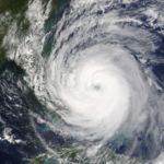
The most unusual storm of the season was Hurricane Ivan. Ivan first impressed meteorologists by becoming the first major Atlantic hurricane (Category 3 or above) on record to form as low as 10°N latitude. Ivan was also recorded as the sixth most intense Atlantic hurricane on record up to that point (since pushed down to tenth), with a minimum central pressure of 910 mbar ( hPa). One very unusual occurrence in relation to Ivan happened on September 22, when a remnant low from Ivan — which had traveled in a circular motion over the southeastern United States — was reclassified as a tropical depression as it moved over the Gulf of Mexico. The system was given the name Ivan and eventually strengthened into a respectable tropical storm with winds of 65 mph (100 km/h) before making landfall along the coast of Texas, causing minimal flooding and damage.
Although not part of the Atlantic hurricane season, one event in the South Atlantic was so unusual as to merit mention. On March 25, a tropical cyclone (unofficially named Cyclone Catarina) formed in the South Atlantic. Catarina is considered to be the first tropical cyclone of hurricane strength to have formed in the South Atlantic since satellite observations began. It made landfall late on March 27 in the Brazilian state of Santa Catarina. The storm killed at least three and caused over $350 million (2004 USD) in damage.
Storms
| Contents |
|
|||||||||||||||||||||||||||||||||||||||||
|---|---|---|---|---|---|---|---|---|---|---|---|---|---|---|---|---|---|---|---|---|---|---|---|---|---|---|---|---|---|---|---|---|---|---|---|---|---|---|---|---|---|---|
|
|
Hurricane Alex
|
||||
|---|---|---|---|---|
|
||||
| Duration | July 31 – August 6 | |||
| Intensity | 120 mph (190 km/h), 957 mbar | |||
The first storm of the season formed at the end of July off the coast of South Carolina. Alex strengthened into a Category 2 hurricane, and on August 3 came within 10 miles (16 km) of the Outer Banks of North Carolina without making landfall. Damage was limited to flooding and wind damage, and in Dare County, North Carolina, was estimated at $2.4 million. There were several injuries and one death reported.
Alex later headed out to sea and strengthened to a Category 3 hurricane, making it only the second hurricane on record to have reached Category 3 strength north of 38° N latitude, before becoming extratropical over the north Atlantic.
For the official forecasts, see the NHC's archive on Hurricane Alex.
Tropical Storm Bonnie
|
||||
|---|---|---|---|---|
|
||||
| Duration | August 3 – August 14 | |||
| Intensity | 65 mph (100 km/h), 1001 mbar | |||
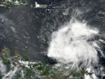
On August 3, a tropical wave approaching the Lesser Antilles organized into Tropical Depression Two. As the storm traveled west over the islands, it dissipated on August 4. The remnants of Tropical Depression Two continued westward and, on August 9, had strengthened into Tropical Storm Bonnie in the Yucatan Channel. Although appearing disorganized, Bonnie showed unusual structure, with a closed eye wall and a ten-mile (16 km) wide eye being reported by hurricane hunters late on August 9 and early on August 10, a feature almost unheard of in tropical cyclones of that intensity. Bonnie was a very small storm, with tropical storm-force winds extending only 30 miles (50 km) out from the centre. Upper level shear weakened the storm, and Bonnie made landfall as a 45 mph (72 km/h) tropical storm just south of Apalachicola, Florida on August 12. It accelerated northeastward, and became a remnant area of low pressure on August 14 to the southeast of New Jersey.
Bonnie caused minor to moderate damage across its path. In the southeast United States, the storm caused a tornado outbreak that caused $500,000 (2004 USD) in damage and 3 deaths. In New Brunswick, slick rains from the remnants of Bonnie caused an indirect fatality.
For the official forecasts, see:
- the NHC's archive on Tropical Storm Bonnie.
- the HPC's advisory archive on Bonnie after landfall.
Hurricane Charley
|
||||
|---|---|---|---|---|
|
||||
| Duration | August 9 – August 14 | |||
| Intensity | 150 mph (240 km/h), 941 mbar | |||
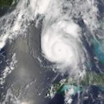
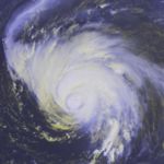
Hurricane Charley formed east of the Windward Islands on August 9 and moved rapidly west across the Caribbean. As it neared Jamaica, it became a hurricane and grazed that island on August 11, passing through the Cayman Islands the next morning. On August 12, Charley passed over mainland Cuba as a Category 3 hurricane just west of Havana.
On August 13, Charley unexpectedly underwent rapid strengthening, jumping from a Category 2 to a powerful Category 4 storm in a few hours, while at the same time taking a sharp turn to the northeast. Charley made landfall as a Category 4 hurricane near Port Charlotte, Florida. Although the storm caused serious damage, much of this was limited to a narrow swath associated with the hurricane's eye wall. Charley was a very fast-moving, compact storm, and so much of its damage was attributed to high winds rather than heavy rain, as is the case in most hurricanes. Charley remained a hurricane across the entire Florida peninsula and passed near Orlando and Daytona Beach. It later made a second landfall near North Myrtle Beach, South Carolina, on August 14. Charley dissipated near Cape Cod, Massachusetts on August 15.
Charley caused approximately $14 billion in damage to the United States, making it the fourth costliest hurricane in U.S. history. Fifteen deaths were directly attributed to Charley; four in Jamaica, one in Cuba, and ten in Florida.
For the official forecasts, see the NHC's archive on Hurricane Charley.
Hurricane Danielle
|
||||
|---|---|---|---|---|
|
||||
| Duration | August 13 – August 21 | |||
| Intensity | 110 mph (175 km/h), 964 mbar | |||
At 11 a.m. AST on August 13, a tropical wave formed into Tropical Depression Four around 275 miles (440 km) southeast of Cape Verde. It was the first of five Cape Verde-type hurricanes of 2004. Twelve hours later, TD4 strengthened and was named Tropical Storm Danielle. Late on August 14, Danielle's wind speeds increased, and it was classified as a hurricane. Danielle moved northwest, peaking at Category Two. It was predicted to curve towards the Azores, but on August 18 lost motion and slackened to a tropical storm. By August 19, the storm had become stationary with minimal storm strength 810 miles (1305 km) southwest of the Azores. The storm was downgraded to a tropical depression the next day, and degenerated to a broad low-pressure area on August 21.
For the official forecasts, see the NHC's archive on Hurricane Danielle.
Tropical Storm Earl
|
||||
|---|---|---|---|---|
|
||||
| Duration | August 13 – August 16 | |||
| Intensity | 50 mph (80 km/h), 1009 mbar | |||
Earl formed initially as the fifth tropical depression of the season on August 13 east of the Lesser Antilles. After traveling west, it reached tropical storm strength on August 14 around 375 miles (605 km) southeast of Barbados. On August 15, Earl passed just south of Grenada and entered the Caribbean. The storm had degenerated by that point, and that night would have been classified as a tropical wave. However, the government of Venezuela denied access to their airspace for storm reconnaissance aircraft. An on-site assessment of Earl's circulation was needed, since satellite observations are inaccurate for that purpose. Earl also posed a threat to land, so advisories continued for another 12 hours.
The next morning a reconnaissance aircraft was able to reach the storm. It found no closed circulation, and Earl was reclassified as a tropical wave at 11 a.m. AST on August 16. Remnants of the storm continued across the Caribbean and into Central America, later becoming Tropical Depression 8E and then Hurricane Frank in the Pacific Ocean (the first time since 1996, when Hurricane Cesar became Douglas in the Pacific). Earl caused minor damage to Grenada and St. Vincent and the Grenadines.
For the official forecasts, see the NHC's archive on Tropical Storm Earl. See also 2004 Pacific hurricane season for information on Earl after it crossed oceans.
Hurricane Frances
|
||||
|---|---|---|---|---|
|
||||
| Duration | August 25 – September 10 | |||
| Intensity | 145 mph (230 km/h), 935 mbar | |||
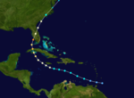
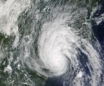
Frances began as Tropical Depression Six on August 24, and it became a named storm on August 25 while well east of the Windward Islands. Frances strengthened rapidly, reaching Category 4 intensity by August 27. Initially forecast to turn north and potentially threaten Bermuda, conditions changed and Frances's predicted track shifted westward. After grazing the Turks and Caicos Islands, it plowed through the Bahamas. From September 2 through September 4, Frances slowly ground its way across the Bahamas. Its slow movement allowed a record 2.5 to 3 million Floridians to evacuate their homes. However, as it ground its way across the Bahamas, it weakened to a Category 2 hurricane due to wind shear, although it was still a very large storm.
After sitting stationary off the coast of Florida for nearly 24 hours, Frances finally moved onto the coast of Florida in the early hours of September 5. It traveled northwest over land, briefly emerging over the Gulf of Mexico and striking the Florida panhandle. As it passed over Georgia on September 6, it caused heavy rainfall across the southern U.S. Over 15 inches (380 mm) of rain were recorded in some places in North Carolina and Virginia, causing heavy flooding. Frances was downgraded to a tropical depression and dissipated over Pennsylvania on September 9.
Damage to the United States was approximately $9 billion, making it the 10th costliest hurricane in U.S. history. Most of Hurricane Frances's damage occurred in Florida as a result of the storm's slow movement, large size, and long duration of winds. The storm is directly responsible for seven deaths; one in the Bahamas and six in the United States. Hurricane Frances also produced a record-setting 123 tornadoes as it moved its way through the United States.
For official forecasts, see:
- the NHC's archive for Hurricane Frances.
- the HPC's advisory archive on Frances after landfall.
Hurricane Gaston
|
||||
|---|---|---|---|---|
|
||||
| Duration | August 27 – September 1 | |||
| Intensity | 75 mph (120 km/h), 986 mbar | |||
Tropical Depression Seven formed at 5 p.m. EDT (2100 UTC) on August 27, around 140 miles (225 km) southeast of Charleston, South Carolina. The depression meandered off the coast for the rest of the day, strengthening into Tropical Storm Gaston by midday August 28. At 10 a.m. EDT (1400 UTC) on August 29, Gaston made landfall on the coast of Bulls Bay, South Carolina, near the towns of McClellanville and Awendaw. It was downgraded to a tropical depression later that day. The storm made landfall in almost the same location as Hurricane Hugo in 1989.
At landfall the storm was originally classified as just shy of hurricane strength. While wind damage in South Carolina was minimal, the slow-moving storm produced five to ten inches (125 to 250 mm) of rain along its path, causing extensive flooding. Gaston moved north over land, weakening to a tropical depression but still bringing torrential rain to central Virginia, where at least eight people were killed in the ensuing floods. The Shockoe Bottom entertainment district near downtown Richmond was devastated by the flooding. Total damage was estimated at about $130 million.
Late on August 30, as Tropical Depression Gaston crossed Chesapeake Bay, its winds strengthened, and it was again classified as a tropical storm. It headed out over the Atlantic and became extratropical on September 1, about 185 miles (300 km) southeast of Halifax, Nova Scotia.
On November 19, after a detailed analysis by the NHC, surface-level winds were determined to be about 75 mph (120 km/h) at landfall, and Gaston was reclassified as a Category 1 hurricane.
For official forecasts, see the NHC's archive on Hurricane Gaston.
Tropical Storm Hermine
|
||||
|---|---|---|---|---|
|
||||
| Duration | August 27 – August 31 | |||
| Intensity | 60 mph (95 km/h), 1002 mbar | |||
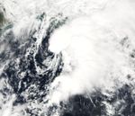
Hermine formed out of an organized area of disturbed weather that had formed about 325 miles (520 km) southeast of Cape Hatteras, North Carolina, or 360 miles (580 km) west of Bermuda, and moved rapidly north towards Cape Cod. On its northward trek, Hermine left behind most of its convection. The storm made landfall near New Bedford, Massachusetts, early on August 31, appearing as little more than a low-level swirl of clouds. It became extratropical a few hours later. The remnant low centre tracked up the Bay of Fundy later on August 31. Some rainfall and thunderstorms over Long Island and parts of New England were attributed to Hermine, but most people did not realize a tropical storm had struck.
There were no casualties or reports of major damage caused by Hermine. Locally heavy rain did fall in portions of southern New Brunswick, which received 40–55 mm. Minor basement flooding and street closures were also reported in Moncton, New Brunswick.
For the official forecasts, see the NHC's archive on Tropical Storm Hermine.
Hurricane Ivan
|
||||
|---|---|---|---|---|
|
||||
| Duration | September 2 – September 24 | |||
| Intensity | 165 mph (265 km/h), 910 mbar | |||
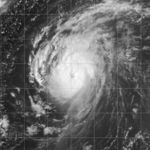
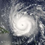
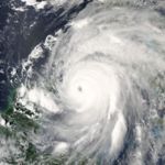
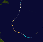
Ivan was a Cape Verde-type hurricane that began as Tropical Depression Nine on September 2. It became a tropical storm on September 3, and a hurricane on September 5 while 1,040 miles (1670 km) east of the Windward Islands, at 9.9° N. Later that day, while at 10.6° N, it unexpectedly underwent rapid strengthening, reaching Category 4 intensity by that evening. It was the strongest storm to have ever been known to intensify that far south. Ivan weakened slightly while continuing westward, and struck Grenada on September 7.
While moving westward through the Caribbean Sea, Ivan quickly intensified to a Category 5 hurricane. It fluctuated in strength over the next few days, and passed within 30 miles (50 km) of Grand Cayman on September 11. Ivan grazed western Cuba as a Category 5, and moved into the Gulf of Mexico. The hurricane turned northward over cooler waters, and made landfall in southern Alabama on September 16 as a 130 mph (210 km/h) hurricane. Ivan weakened rapidly to a tropical depression over Alabama, accelerated to the northeast, and became extratropical over the Delmarva Peninsula on September 18. Ivan's remnants turned to the southeast then southwest, and gradually re-organized over the warm Gulf Stream waters. After crossing southern Florida on September 21 the system regained tropical characteristics over the Gulf of Mexico, and became a tropical storm on September 23 while 140 miles (220 km) south of Louisiana. Ivan moved to the northwest, and reached winds of 60 mph (95 km/h) before making landfall near Cameron, Louisiana. Ivan quickly deteriorated over Texas, and dissipated on September 24.
Hurricane Ivan directly killed 92 people throughout the Caribbean and United States and caused approximately $13 billion in damage to the United States, making it the fifth costliest hurricane in United States history. The hurricane destroyed 90% of Grenada's structures and devastated the island's economy, and destroyed 85% of the buildings on Grand Cayman. The combination of Hurricane Ivan with the previous rains of Frances brought many rivers in the Southeastern U.S. to near-record flood levels. Ivan was the strongest storm of the season, and the only 2004 Atlantic hurricane to reach Category 5 intensity. Its low pressure reading of 910 mbar made it the sixth most intense Atlantic hurricane on record at the time.
For official forecasts see:
- the NHC's public advisory archive on Hurricane Ivan.
- the HPC's advisory archive on Ivan after landfall.
Tropical Depression Ten
|
||||
|---|---|---|---|---|
|
||||
| Duration | September 7 – September 9 | |||
| Intensity | 35 mph (60 km/h), 1013 mbar | |||
In addition to the fifteen named storms, there was a single tropical depression, Tropical Depression 10, which did not strengthen into a tropical storm. It formed on September 7 from a tropical wave, and after moving northeastward it dissipated near the Azores on September 9.
For official forecasts, see the NHC's advisory archive on Tropical Depression Ten
Hurricane Jeanne
|
||||
|---|---|---|---|---|
|
||||
| Duration | September 13 – September 28 | |||
| Intensity | 120 mph (190 km/h), 951 mbar | |||
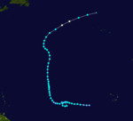
Jeanne formed as a tropical depression east-southeast of Guadeloupe on the evening of September 13. Having strengthened to a tropical storm, Jeanne crossed Puerto Rico on September 15. It then moved toward Hispaniola, barely reaching hurricane strength before making landfall on September 16. It tracked slowly across the northern coast of the Dominican Republic and Haiti, its heavy rains bringing mudslides and flooding. Jeanne's unusually slow journey was actually caused by a weakening Hurricane Ivan. Ivan broke up a trough that was fueling Jeanne's steering currents. Interaction with Hispaniola caused it to degenerate into a tropical depression.
After wreaking havoc on Hispaniola, Jeanne struggled to reorganize. However, it eventually began strengthening and headed north. After performing a complete loop over the open Atlantic, it headed westwards, strengthening into a Category 3 hurricane and passing over the islands of Great Abaco and Grand Bahama in the Bahamas on September 25. Jeanne made landfall later in the day in Florida just 2 miles (3 kilometers) from where Frances had struck 3 weeks earlier. Building on the rainfall of Frances and Ivan, Jeanne brought near-record flood levels as far north as West Virginia and New Jersey before its remnants turned east into the open Atlantic.
Jeanne is blamed for at least 3,006 deaths in Haiti with about 2,800 in Gonaïves alone, which was nearly washed away by floods and mudslides. The storm also caused 7 deaths in Puerto Rico, 18 in the Dominican Republic and at least 4 in Florida, bringing the total number of deaths to at least 3,025. Final property damage in the United States was $6,800,000,000, making this the 13th costliest hurricane in U.S. history.
For official forecasts see:
- the NHC's public advisory archive on Hurricane Jeanne.
- the HPC's advisory archive on Jeanne after landfall.
Hurricane Karl
|
||||
|---|---|---|---|---|
|
||||
| Duration | September 16 – September 28 | |||
| Intensity | 145 mph (230 km/h), 938 mbar | |||
Tropical Depression Twelve formed from a tropical wave about 670 miles (1,080 km) west-southwest of the Cape Verde islands on September 16. It became Tropical Storm Karl at 11 p.m. AST (0300 UTC) that day. Early on September 18, it strengthened rapidly to become a hurricane and was a major hurricane later that day.
Karl continued strengthening and became a 145 mph (230 km/h) Category 4 hurricane on September 21. It fluctuated in intensity over the next few days, reaching Category 4 strength on two different occasions. It moved steadily northwards, staying hundreds of miles from any land, until it began to weaken and become extratropical over cooler waters. Karl was still of Category 1 strength when it became an extratropical system on September 24 over the far northern Atlantic at about 47° N. The extratropical system struck the Faroe Islands two days later with 144 km/h (89 mph) wind gusts.
For official forecasts see the NHC's public advisory archive on Hurricane Karl.
Hurricane Lisa
|
||||
|---|---|---|---|---|
|
||||
| Duration | September 19 – October 3 | |||
| Intensity | 75 mph (120 km/h), 987 mbar | |||
Tropical Depression Thirteen developed from a tropical wave 650 miles (1,045 km) west-southwest of the Cape Verde islands on September 19. It became Tropical Storm Lisa at 8 a.m. AST on September 20 with maximum sustained winds of 50 mph (80 km/h). A very small storm, its development was hindered by its proximity to Hurricane Karl. On September 22, Lisa began merging with a large tropical disturbance to its east and weakened to a tropical depression for a couple of days before regaining tropical storm strength on September 25. By then it was heading generally northwards in the mid-Atlantic. Lisa went through several phases of weakening and strengthening as it headed north, finally reaching hurricane strength on October 1, and again the next day.
At the time, Lisa earned the record for being a named tropical cyclone (i.e., after first reaching Tropical Storm strength) for 11 days before becoming a hurricane. ( Hurricane Dennis of 1981 took longer overall but dropped to a tropical wave before regenerating.) However, Hurricane Irene beat this record in the 2005 Atlantic hurricane season. (Subsequent reevaluation determined that Lisa only became a hurricane on October 2, after 11¾ days as a named cyclone. Its total development time from tropical depression to hurricane, at 12½ days, is second only to Hurricane Josephine of 1990.)
Lisa was a hurricane only briefly, moving over cooler waters and weakening to a tropical storm. It became extratropical early on October 3 while located about 475 miles (760 km) north-northwest of the Azores. It never threatened any land area.
For official forecasts see the NHC's public advisory archive on Hurricane Lisa.
Tropical Storm Matthew
|
||||
|---|---|---|---|---|
|
||||
| Duration | October 8 – October 10 | |||
| Intensity | 45 mph (70 km/h), 997 mbar | |||
Matthew began with a tropical wave that entered the southwestern Gulf of Mexico. This wave grew into a large area of low pressure in the western Gulf. The nontropical low began feeding moisture into a cold front that was traversing the United States, causing heavy rainfall across Louisiana, East Texas, and Arkansas.
On the afternoon of October 8, the low pressure system developed into Tropical Storm Matthew 260 miles (420 km) east-southeast of Brownsville, Texas. Matthew was a minimal tropical storm, and its sustained winds stayed at or near 40 mph (64 km/h) from its naming until landfall on October 10. It became extratropical inland over Louisiana later in the day, and dissipated when it was near El Dorado, Arkansas.
Matthew brought up to 12 inches (300 mm) of rain to southern Louisiana. About a dozen homes were flooded in Terrebonne Parish after a canal levee burst, and streets in St. Bernard Parish were reportedly under 2 feet (60 cm) of water. The remnants of Matthew continued to spin inland and delivered heavy rainfall for at least five more days. No injuries or deaths were reported.
For official forecasts see:
- the NHC's public advisory archive on Tropical Storm Matthew.
- the HPC's advisory archive on Matthew after landfall.
Subtropical Storm Nicole
|
||||
|---|---|---|---|---|
|
||||
| Duration | October 10 – October 11 | |||
| Intensity | 50 mph (85 km/h), 986 mbar | |||
Early on October 10, the National Hurricane Centre determined that a low-pressure system to the west of Bermuda had acquired sufficient organization to be named Subtropical Storm Nicole. It brought light rain to Bermuda and briefly threatened it before heading towards the northeast. Nicole continued heading generally northeastward over cooler waters and was declared fully extratropical on October 11 while 345 miles (555 km) south-southeast of Halifax, Nova Scotia. The Canadian Hurricane Centre continued to issue advisories on, as they called it, post-tropical Storm Nicole (actually a system absorbed by another extratropical low) for another day as it moved closer to land and dropped heavy rainfall on the Maritimes. The low containing the remnants of Nicole finally merged with another larger low-pressure area while in the vicinity of Anticosti Island on October 14. No injuries or deaths were reported.
Since 2002, subtropical storms have been assigned names from the same sequence as tropical storms. Nicole was the first named storm under this dispensation that never achieved tropical status.
For official forecasts, see the NHC's public advisory archive on Subtropical Storm Nicole.
Tropical Storm Otto
|
||||
|---|---|---|---|---|
|
||||
| Duration | November 29 – December 2 | |||
| Intensity | 50 mph (80 km/h), 995 mbar | |||
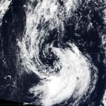
After a period of inactivity lasting seven weeks, Tropical Storm Otto formed on November 30, the last day of the official hurricane season. It developed from a nontropical low-pressure system over the central North Atlantic Ocean. Otto moved generally south and southwest for a few days as a minimal tropical storm before degenerating on December 2.
For official forecasts, see the NHC's public advisory archive on Tropical Storm Otto.
Season summary
| Storm Name | Active Dates | Storm category at peak intensity |
Max Wind ( mph) |
Min. Press. ( mbar) |
ACE | Landfall(s) | Damage (millions USD) |
Deaths | ||
|---|---|---|---|---|---|---|---|---|---|---|
| Where | When | Wind ( mph) |
||||||||
| Alex | July 31–August 6 | Category 3 Hurricane | 120 | 957 | 11.4 | none | 7.5 | 1 | ||
| Bonnie | August 3–13 | Tropical Storm | 65 | 1001 | 2.62 | St. Vincent Island, Florida | August 12 | 45 | 1.27 | 3 (1) |
| Charley | August 9–14 | Category 4 Hurricane | 150 | 941 | 10.6 | Playa del Cajio, Cuba | 13 August | 120 | 16000 | 15 (20) |
| Cayo Costa, Florida | August 13 | 150 | ||||||||
| Punta Gorda, Florida | August 13 | 145 | ||||||||
| Cape Romain, South Carolina | August 14 | 80 | ||||||||
| North Myrtle Beach, South Carolina | August 14 | 75 | ||||||||
| Danielle | August 13–21 | Category 2 Hurricane | 110 | 964 | 12.1 | none | 0 | 0 | ||
| Earl | August 13–15 | Tropical Storm | 50 | 1009 | 0.77 | none | ? | 0 | ||
| Frances | 27 Aug - 8 Sept | Category 4 Hurricane | 145 | 936 | 45.9 | San Salvador Island, Bahamas | Sept 2 | 125 | 9600 | 7 (42) |
| Cat Island, Bahamas | Sept 3 | 115 | ||||||||
| Eleuthera, Bahamas | September 3 | 110 | ||||||||
| Grand Bahama Island | Sept 4 | 105 | ||||||||
| Hutchinson Island South, Florida | Sept 5 | 105 | ||||||||
| Mouth of Aucilla River, Florida | Sept 6 | 60 | ||||||||
| Gaston | Aug 27 - Sept 1 | Category 1 Hurricane | 75 | 985 | 2.72 | Awendaw, South Carolina | 29 August | 75 | 130 | 8 (1) |
| Hermine | Aug 27–31 | Tropical Storm | 60 | 1002 | 1.34 | New Bedford, Massachusetts | August 31 | 40 | ? | 0 |
| Ivan | Sept 2–24 | Category 5 Hurricane | 165 | 910 | 70.4 | Pine Beach, Alabama | Sept 16 | 120 | 17200 | 92 (32) |
| Holly Beach, Louisiana | Sept 24 | 35 | ||||||||
| Ten | Sept 7–9 | Tropical Depression | 35 | 1009 | 0 | none | 0 | 0 | ||
| Jeanne | 24–29 Sept | Category 3 Hurricane | 120 | 950 | 24.2 | near Guadeloupe | Sept 14 | 35 | 7000 | 3035+ |
| Near Guayama, Puerto Rico | Sept 15 | 70 | ||||||||
| Eastern tip of Dominican Republic | Sept 16 | 80 | ||||||||
| Abaco Island, Bahamas | Sept 25 | 115 | ||||||||
| Hutchinson Island South, Florida | Sept 26 | 120 | ||||||||
| Karl | Sept 16 - Sept 24 | Category 4 Hurricane | 145 | 938 | 28.4 | none | 0 | 0 | ||
| Lisa | Sept 19 - Oct 3 | Category 1 Hurricane | 75 | 987 | 12.2 | none | 0 | 0 | ||
| Matthew | Oct 8–10 | Tropical Storm | 45 | 997 | 1.01 | Cocodrie, Louisiana | Oct 9 | 40 | .03 | 0 |
| Nicole | Oct 10–11 | Tropical Storm | 50 | 986 | N/A | none | 0 | 0 | ||
| Otto | Nov 29–Dec 3 | Tropical Storm | 50 | 995 | 1.01 | none | 0 | 0) | ||
| Season Aggregates | ||||||||||
| 15 cyclones | July 31 - Dec. 3 |
165 | 910 | 225 | 22 landfalls | 50000 | 3069+ (96) | |||
Accumulated Cyclone Energy (ACE) Ranking
| Highest ACE hurricane seasons (since 1850, source) |
||
|---|---|---|
| Rank | Season | ACE |
| 1 | 2005 | 248 |
| 2 | 1950 | 243 |
| 3 | 1893 | 231 |
| 4 | 1995 | 227 |
| 5 | 2004 | 224 |
| 6 | 1926 | 222 |
| 7 | 1933 | 213 |
| 8 | 1961 | 205 |
| 9 | 1955 | 199 |
| 10 | 1887 | 182 |
| Main article: Accumulated Cyclone Energy | ||
| ACE (104 kt2) – Storm: Source | |||||
|---|---|---|---|---|---|
| 1 | 70.4 | Ivan | 8 | 10.6 | Charley |
| 2 | 45.9 | Frances | 9 | 2.72 | Gaston |
| 3 | 28.4 | Karl | 10 | 2.62 | Bonnie |
| 4 | 24.2 | Jeanne | 11 | 1.34 | Hermine |
| 5 | 12.2 | Lisa | 12 | 1.01 | Matthew |
| 6 | 12.1 | Danielle | 1.01 | Otto | |
| 7 | 11.4 | Alex | 14 | 0.77 | Earl |
| Total=225 | |||||
The tropical storms of 2004 ranked from highest to lowest Accumulated Cyclone Energy (ACE) given to three significant figures. The total for the season was 225. This makes it the fourth most energetic season since 1950.
ACE measures the strength and duration of a tropical cyclone. Hurricane Ivan, because it was such a long lasting and strong Cape Verde-type hurricane, contributed almost one-third of the ACE value for 2004. Ivan had the second-highest ACE of any tropical cyclone recorded in the Atlantic, behind only Hurricane San Ciriaco of 1899.
Storm names
The following names were used for named storms that formed in the Atlantic basin in 2004. The names not retired from this list will be used again in the 2010 season. This is the same list used for the 1998 season except for Gaston and Matthew, which replaced Georges and Mitch. Storms were named Gaston, Matthew, and Otto for the first time in 2004. Names that were not assigned are marked in gray.
|
|
Retirement
The World Meteorological Organization retired four names in the spring of 2005: Charley, Frances, Ivan, and Jeanne. They will be replaced in 2010 by Colin, Fiona, Igor, and Julia. The 2004 season was tied with the 1955 season and 1995 season for the most storm names retired after a single season until the 2005 season, when five names were retired.
